Water
Water Quality Sampling in the Upper Wapsipinicon River Watershed
The Upper Wapsipinicon River Watershed is fairly new to surface water quality monitoring at the whole watershed scale. The Upper Wapsipinicon River Watershed Management Authority started water sampling with the help from partner organizations in 2015. Since then, samples were gathered in 2016, 2017, and currently in 2019. Due to lack of funding and volunteers no samples were collected during the 2018 season. Currently in 2019, samples are collected twice a month during May and June (on the first and third Monday of the month) and once a month (on the third Monday) from July to October. Samples are gathered from 22 locations across the UWRW. This data provides a snapshot of the entire watershed on a given day each month and allows the comparison of one stream/watershed to the next. For example, watersheds of streams in Howard County can then be compared and contrasted with similarly-sized watersheds that empty into the Upper Wapsipinicon 100-miles downstream in Jones County. Water samples are collected on the same day by 7 public and private organizations including, Buchanan SWCD, Buchanan County Conservation, Iowa State Extension, NRCS, Linn County Conservation, Black Hawk County Health Department, and Chickasaw County Conservation. Once samples are gathered they are packed on ice, and sent to the Coe College laboratory for analysis. The samples are analyzed for concentrations of E. coli Bacteria, Nitrate, Total Phosphate as P, Chloride, Sulfate, and Total Suspended Solids.
Continued data collection over a wide spatial area of the UWR Watershed allows for a better understanding of the water quality problems in the Watershed, and allows landowners, citizens and organizations to find ways to solve the issues related to poor water quality. Extensive water monitoring data can result in increased funding for effective watershed projects, bringing tens of millions of dollars in state and federal cost share to help private landowners implement voluntary conservation practices, as well as funding for SWCDs and other organizations to hire conservation professionals, including technicians and engineers, to provide free technical assistance to watershed residents.
Interact with the maps below to learn more about the water sampling data by subwatershed. Click any of the water quality parameter buttons below to learn about water quality results in the UWR Watershed
Water Quality Data by Sampling Site
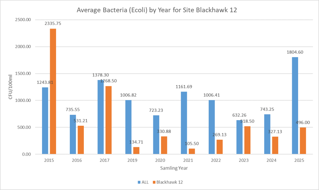
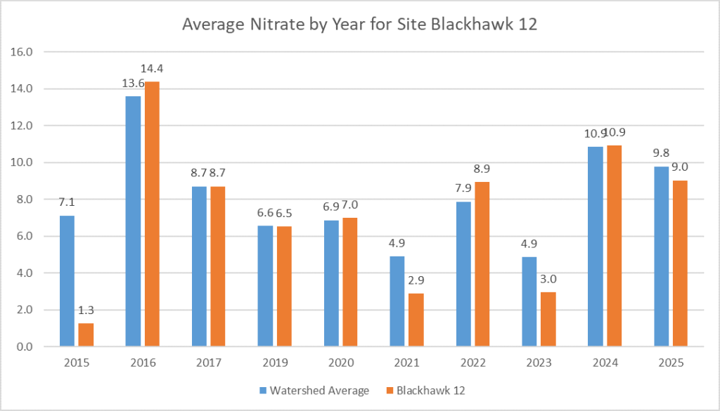
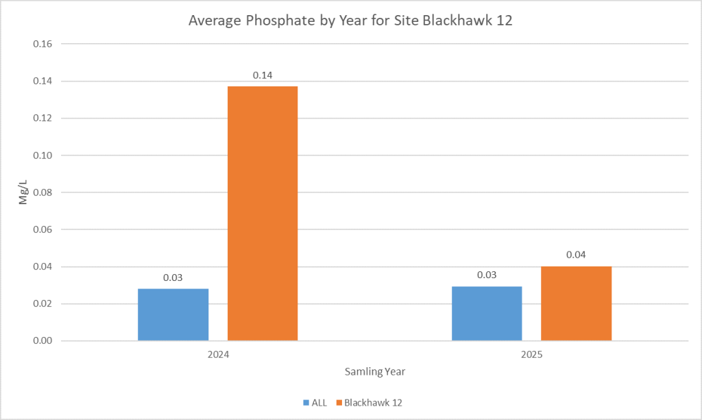
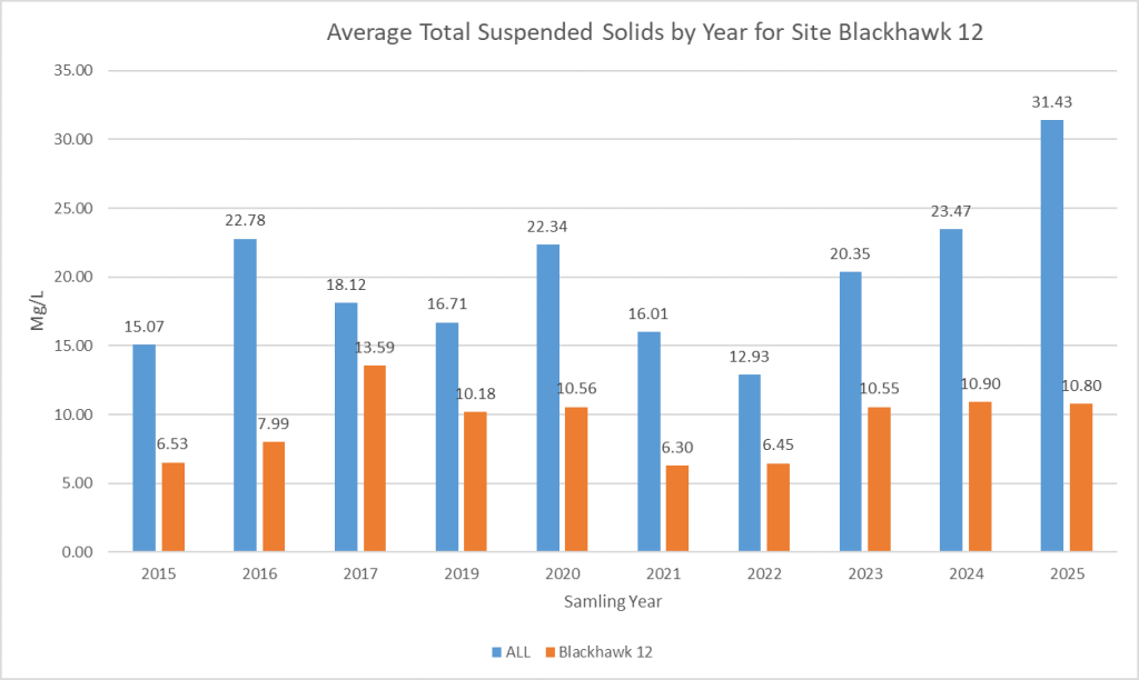
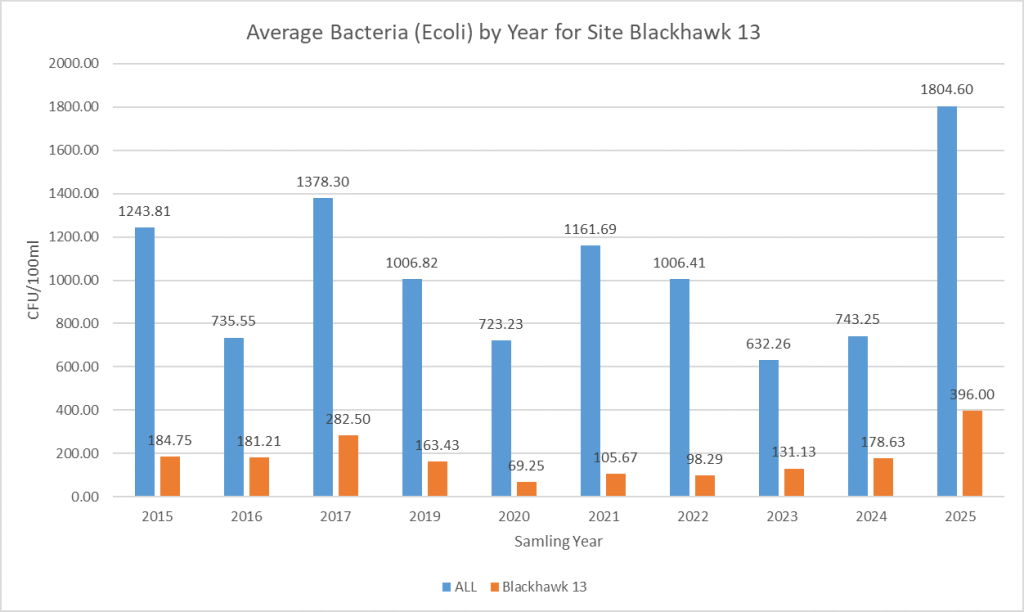
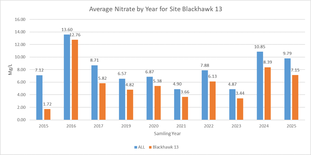
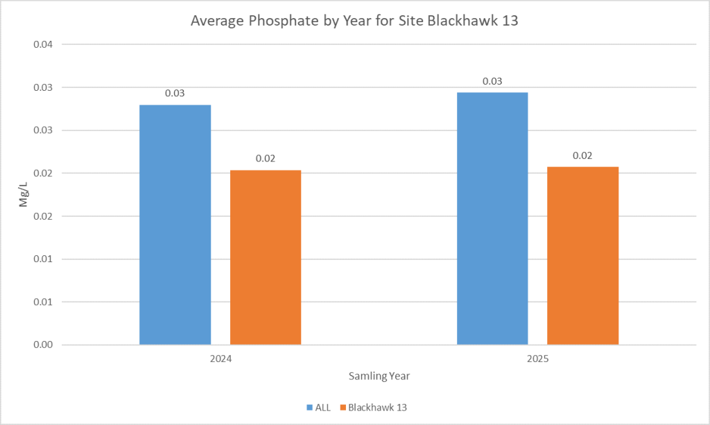
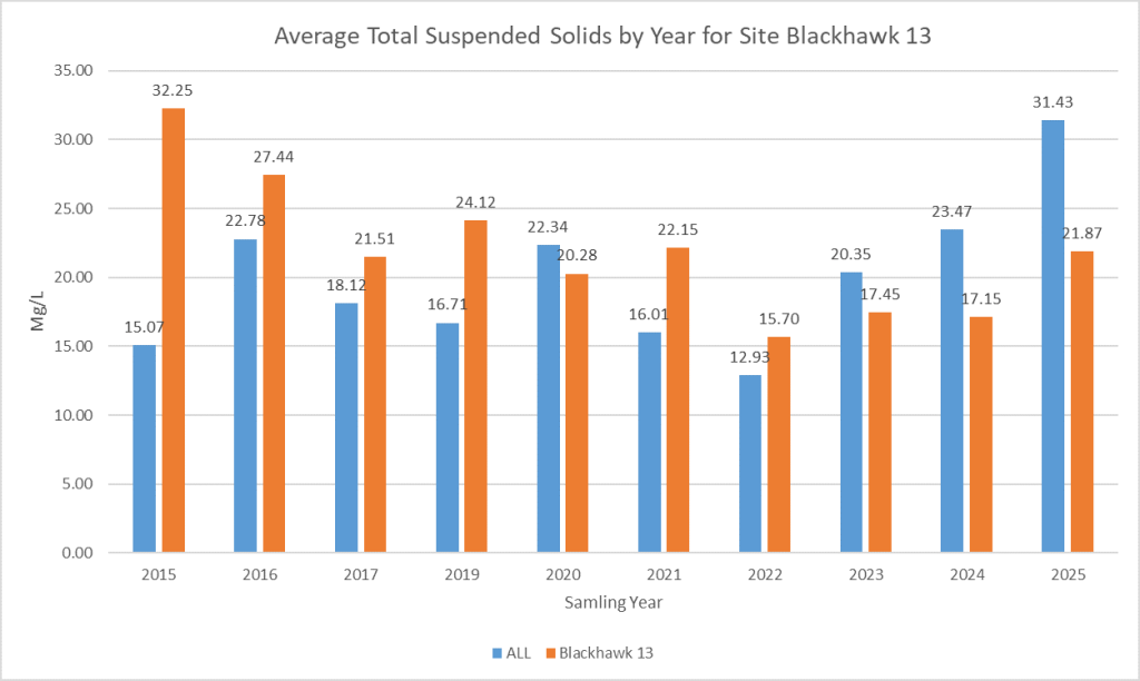
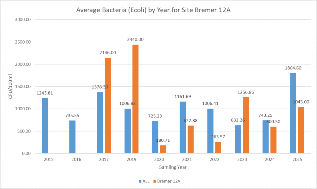
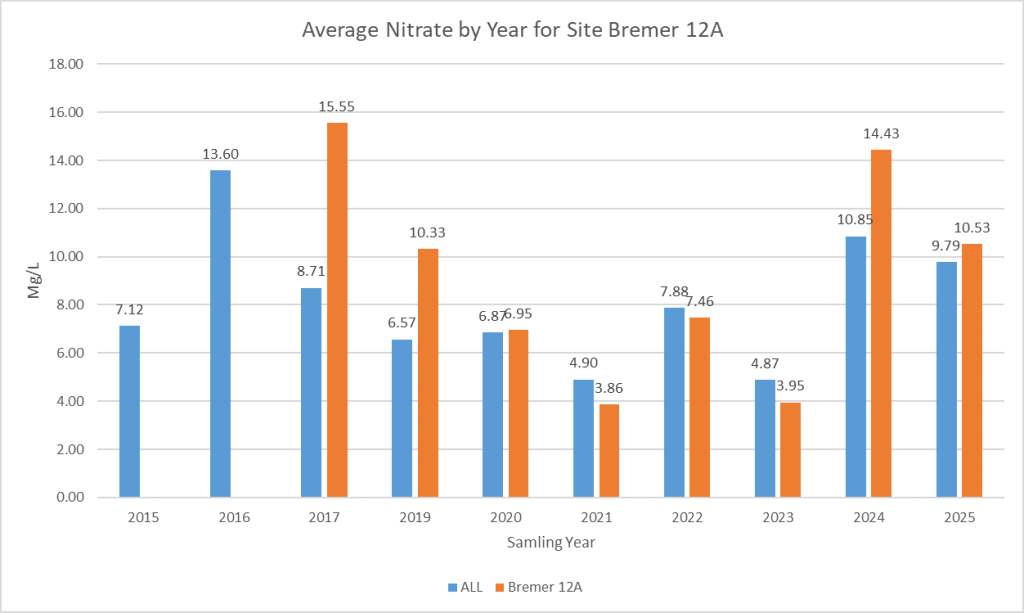
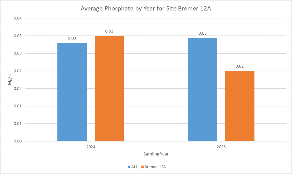
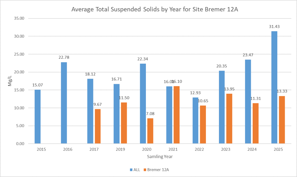
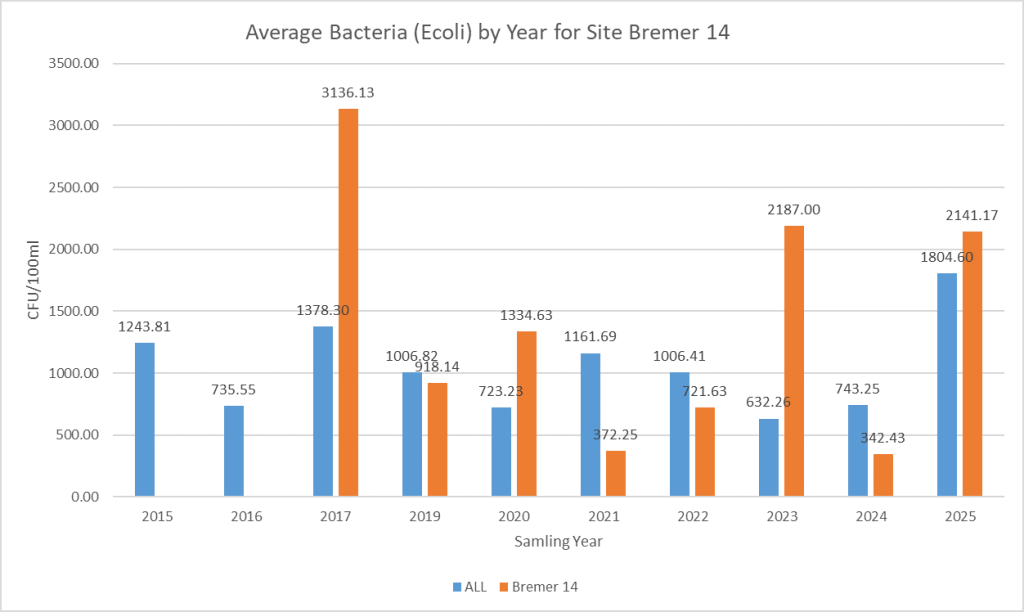
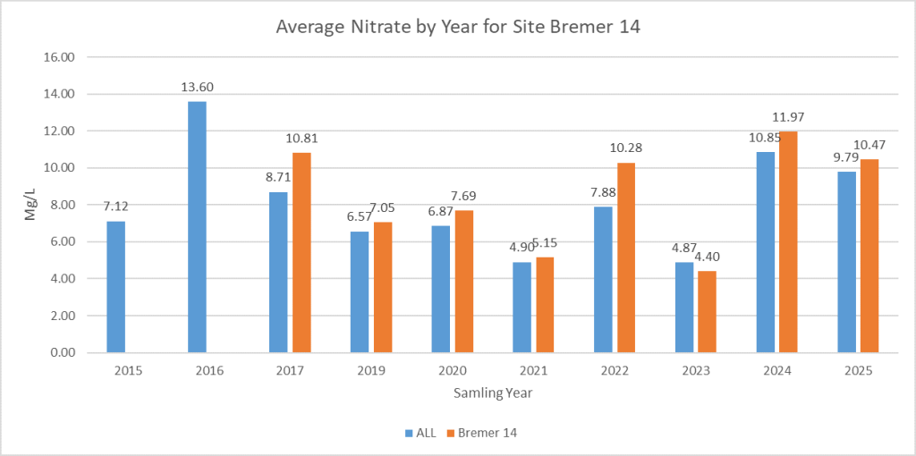
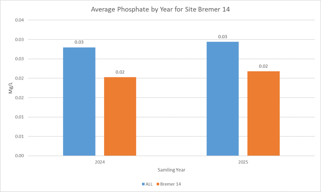
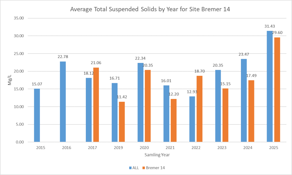
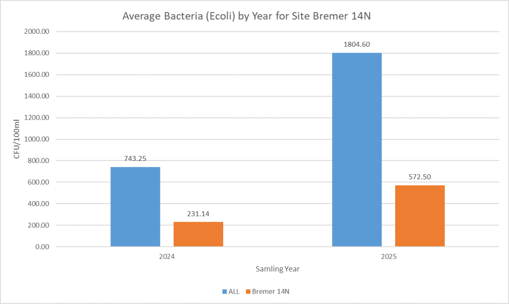
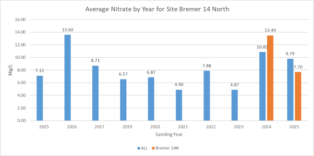
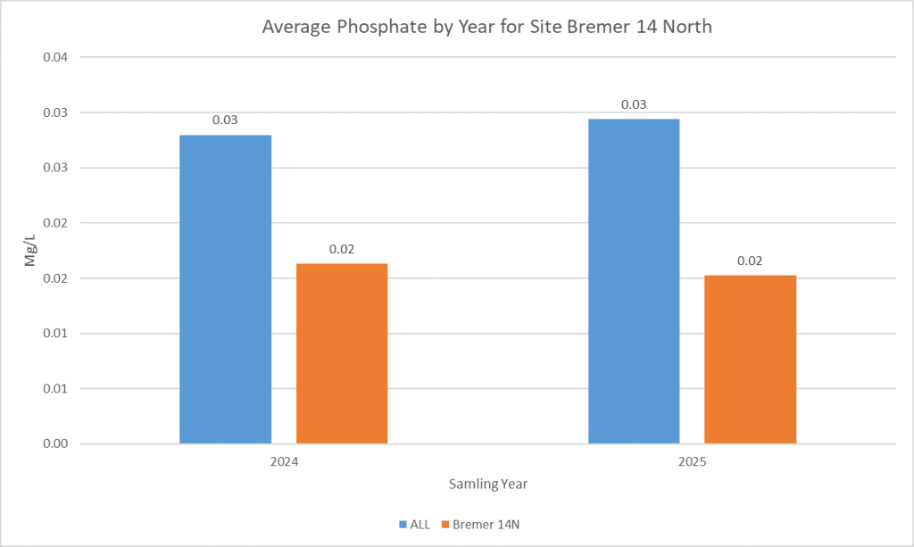
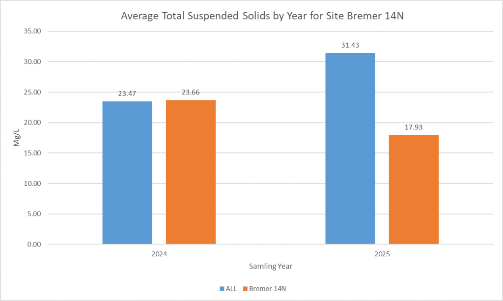
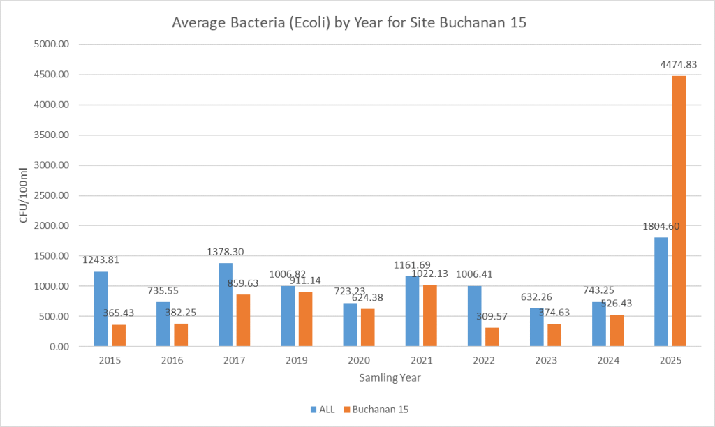
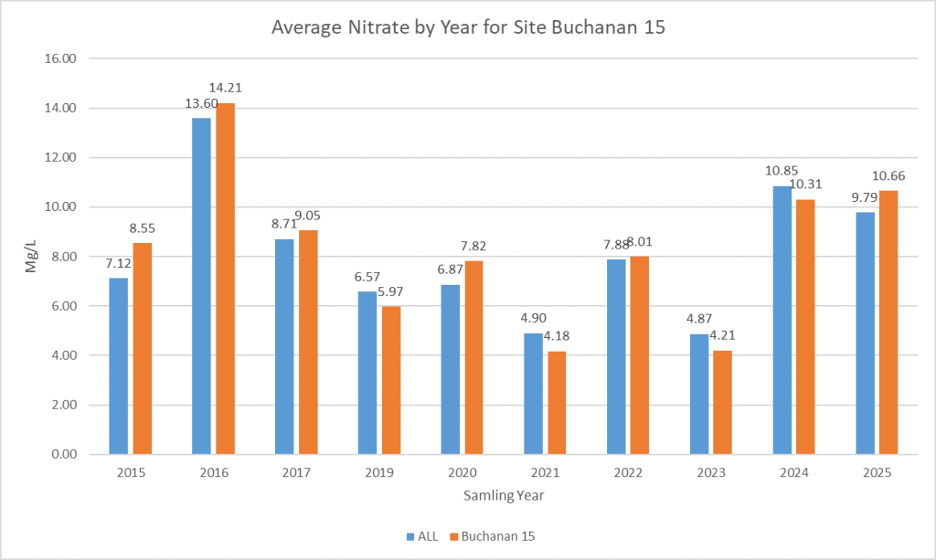
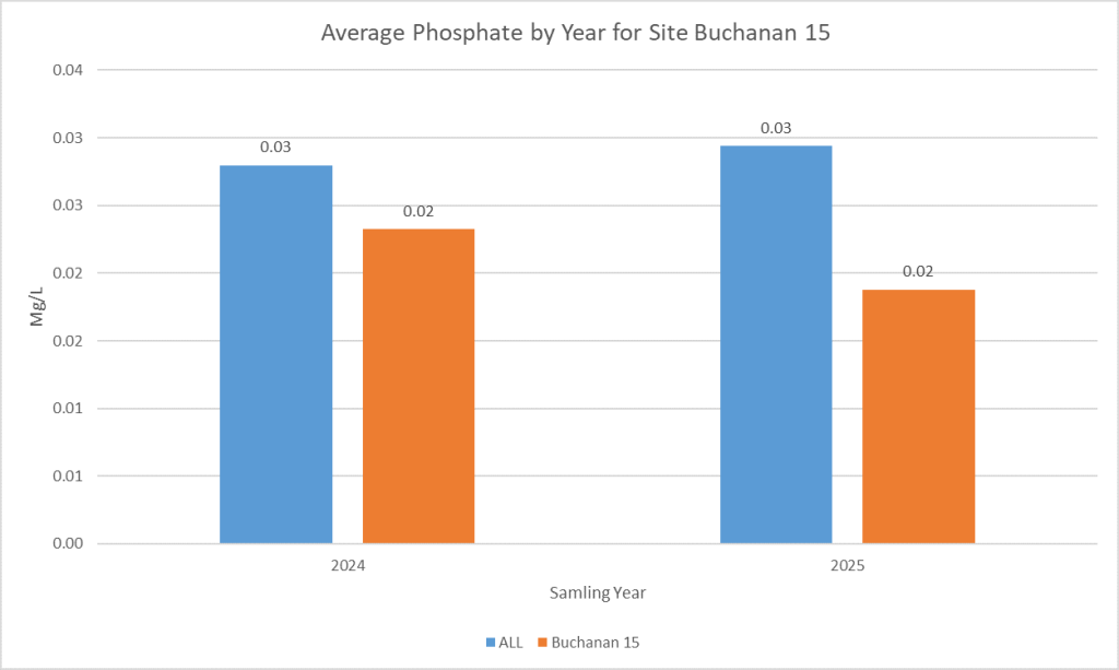
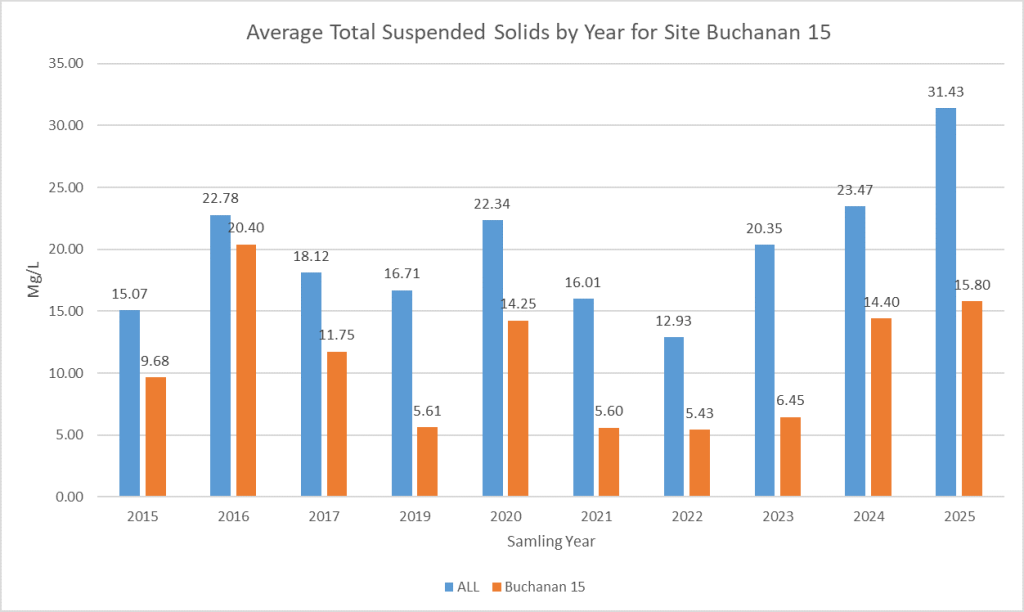
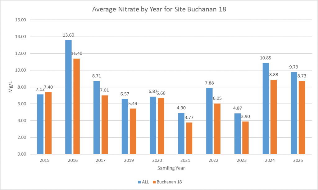
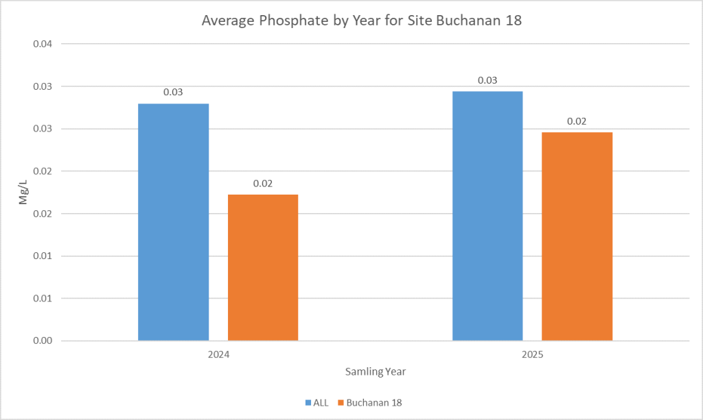
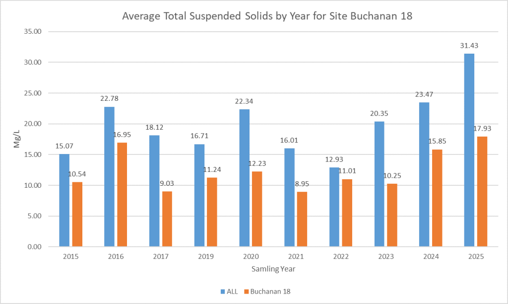
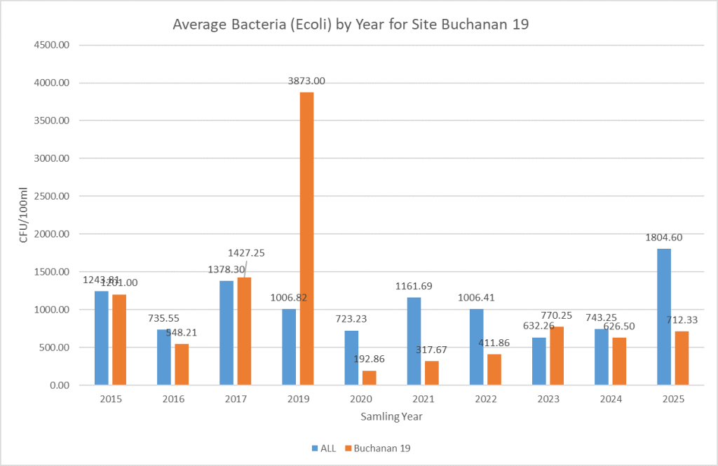
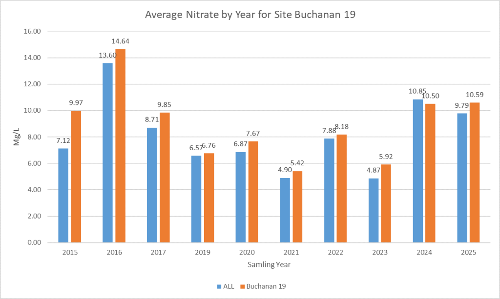
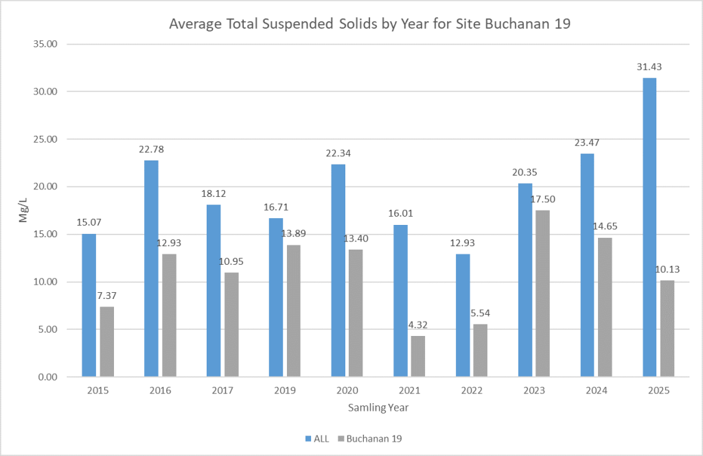
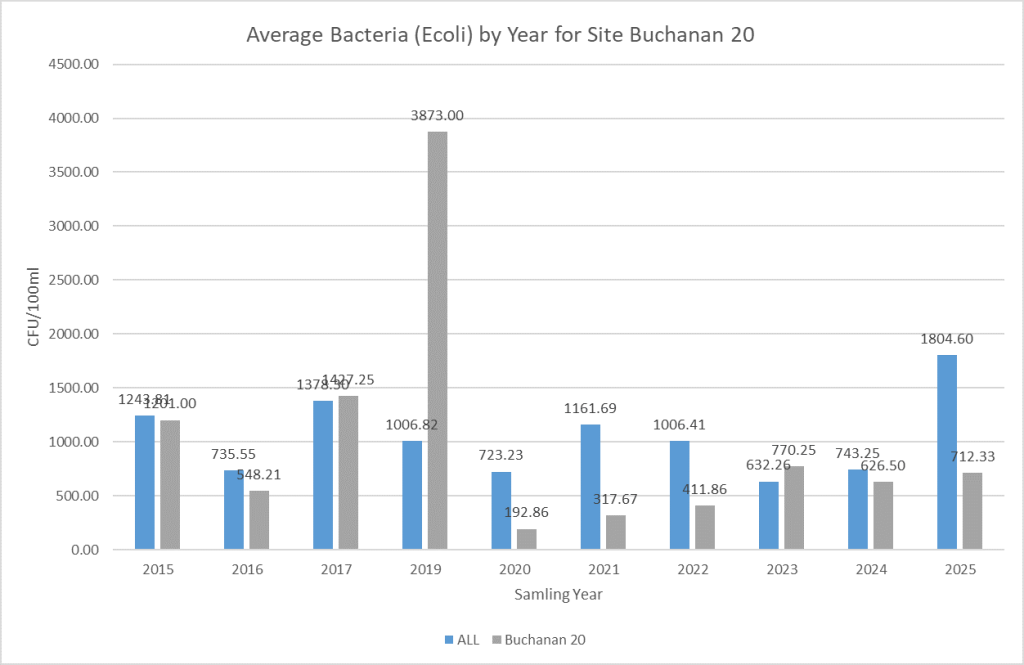
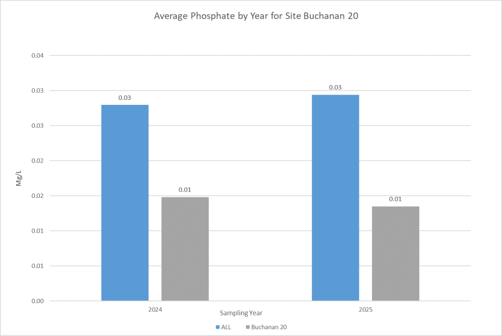
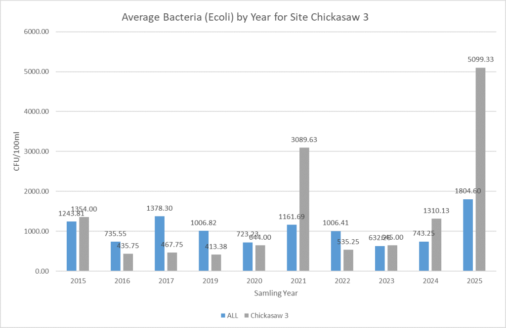
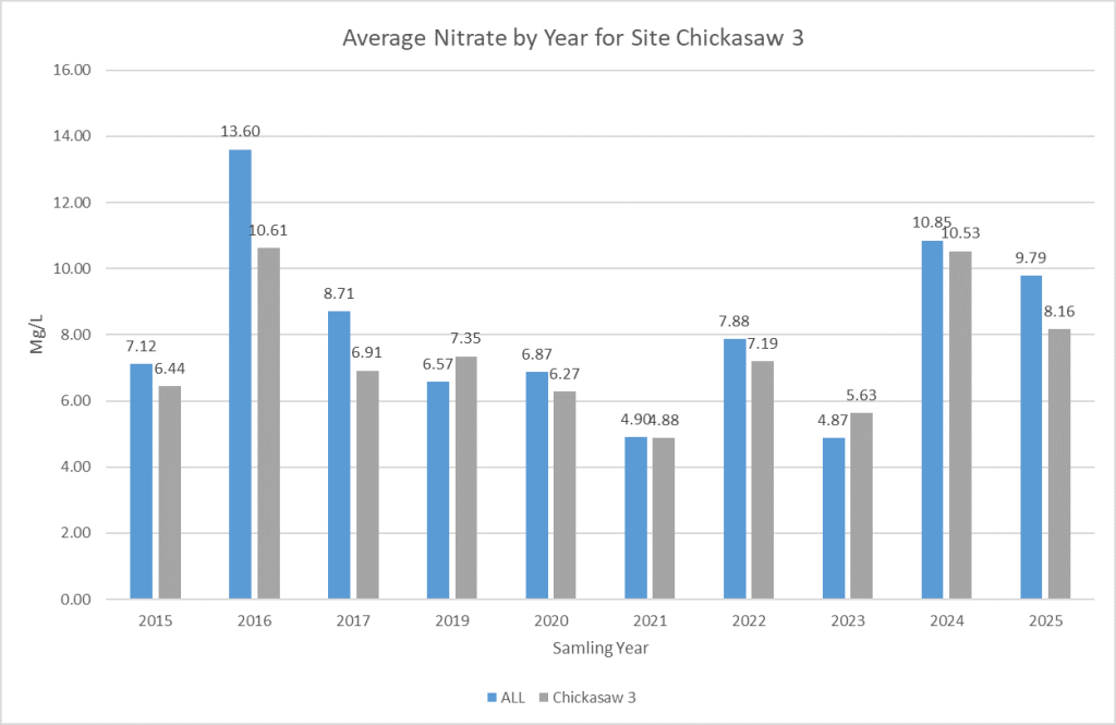
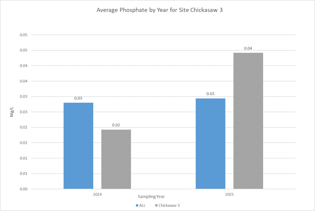
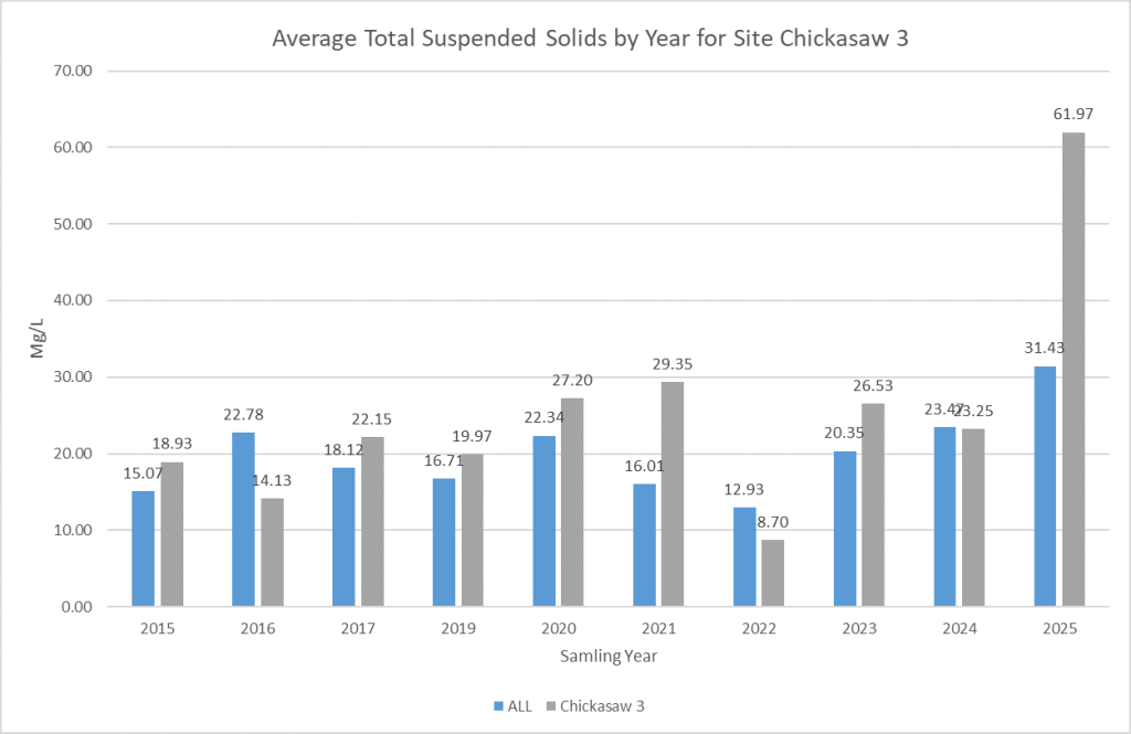
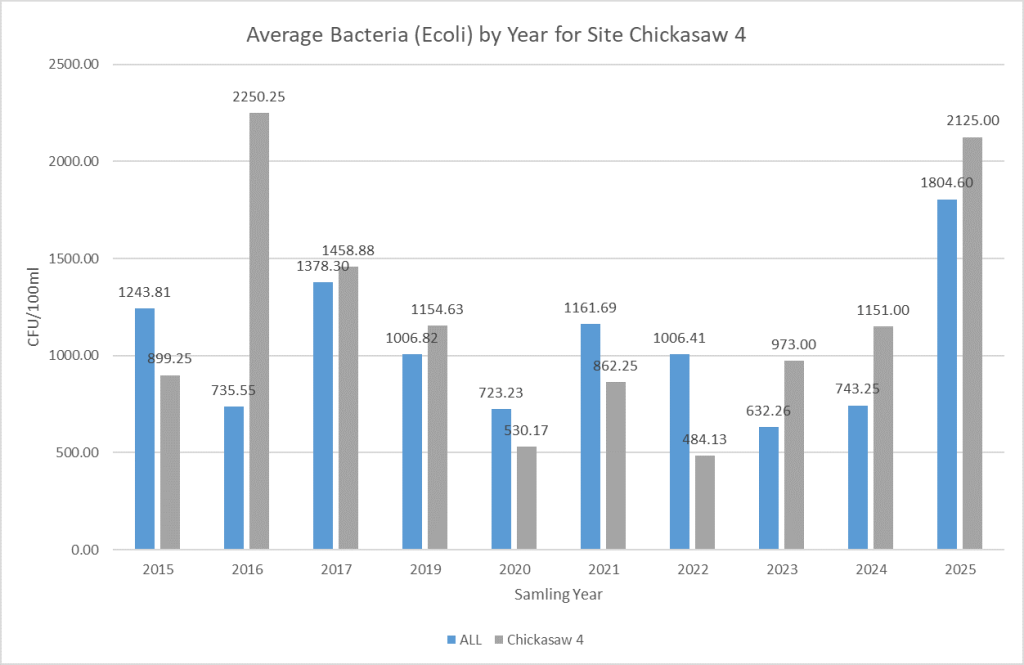
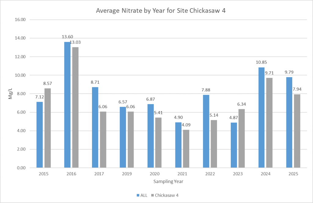
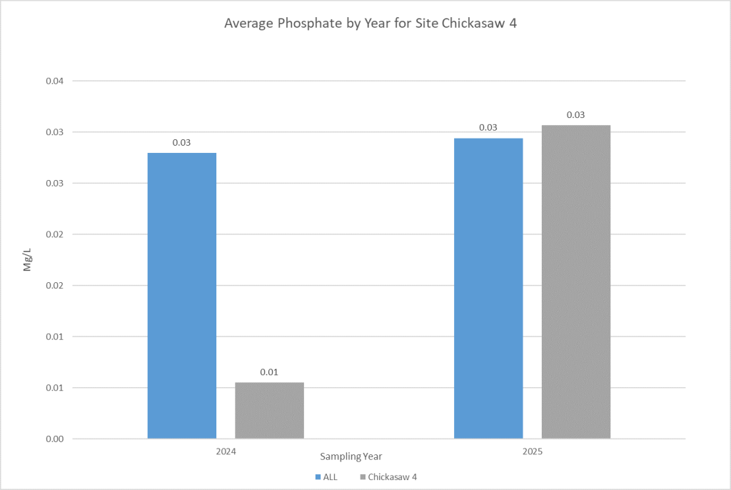
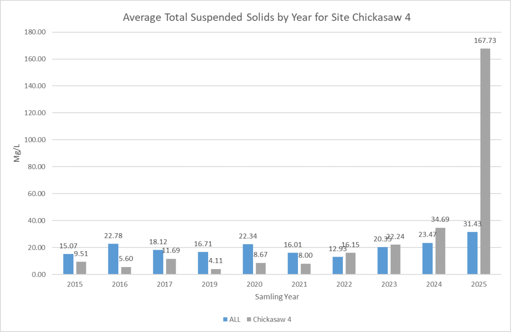
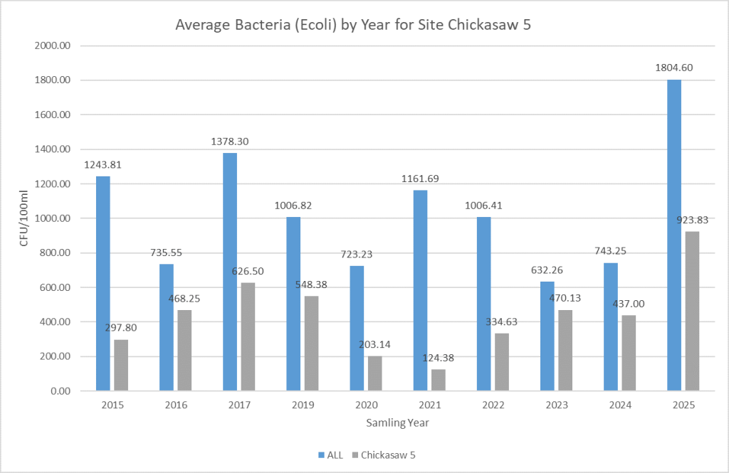
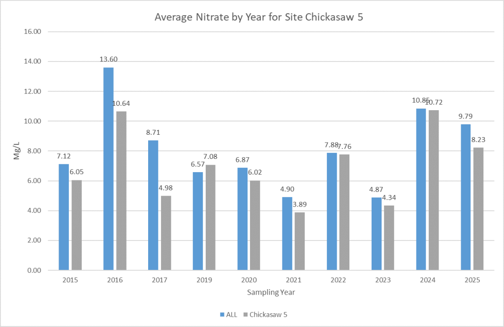
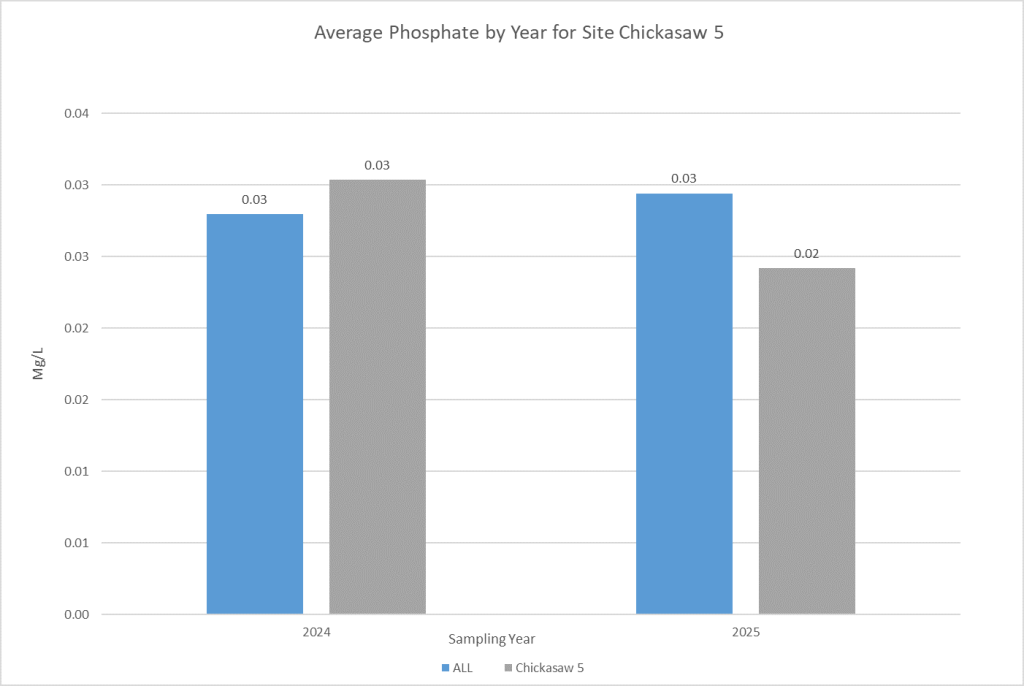
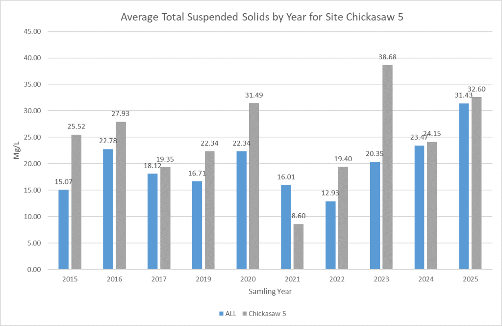
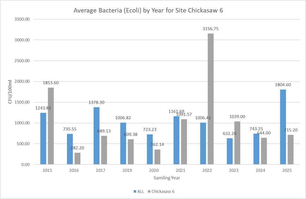
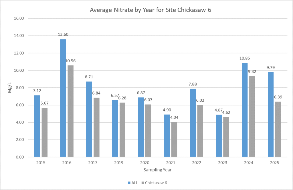
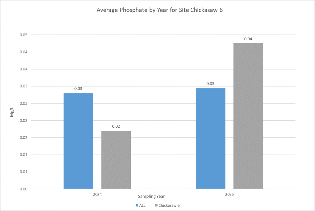
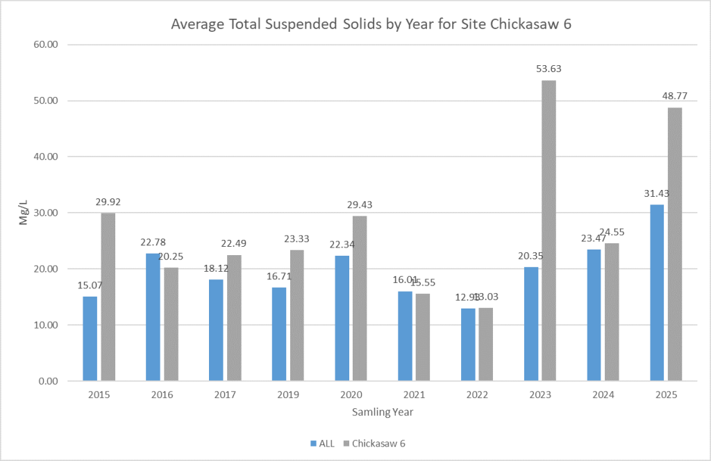
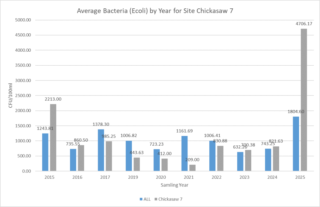
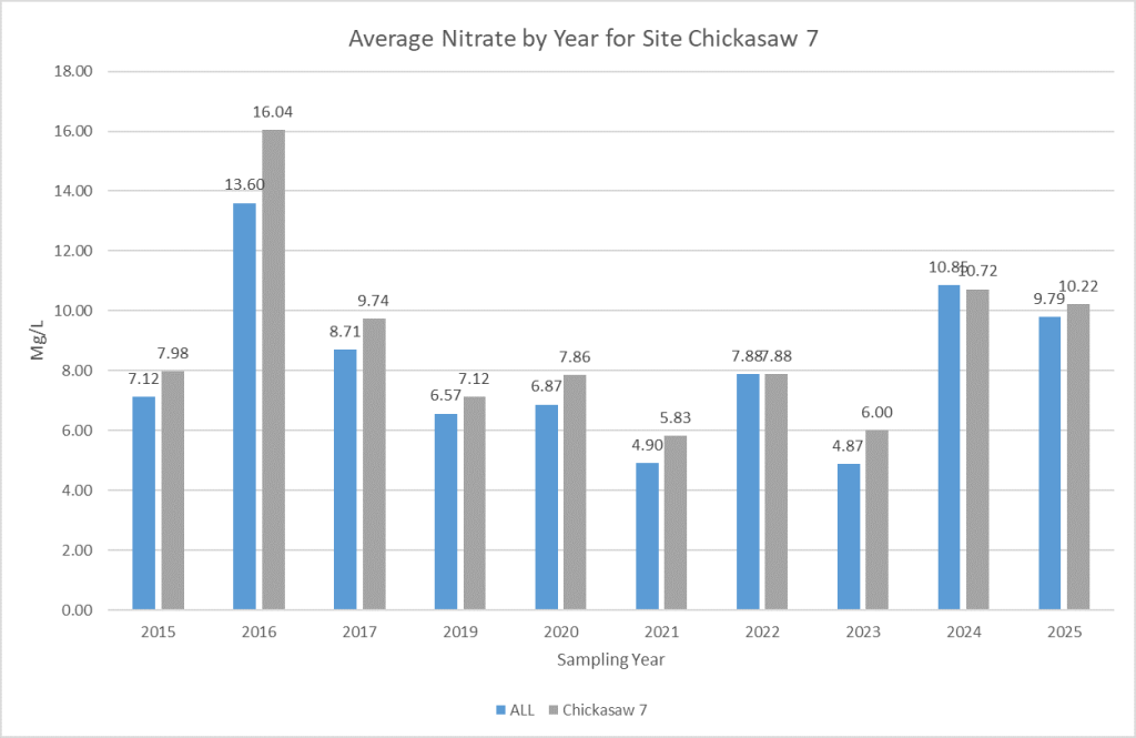
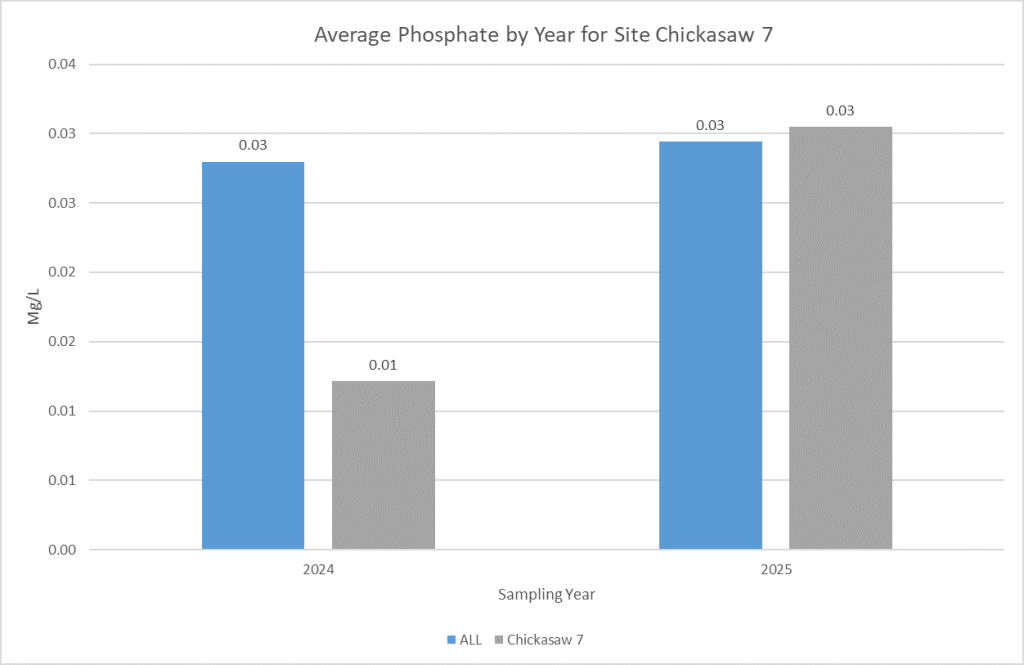
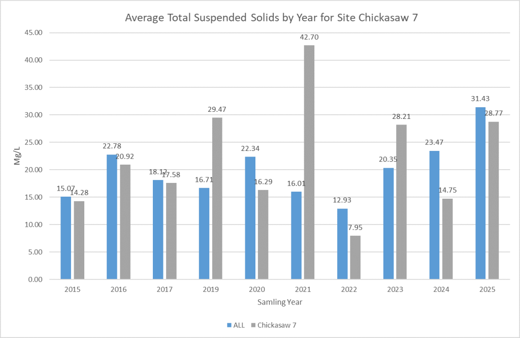
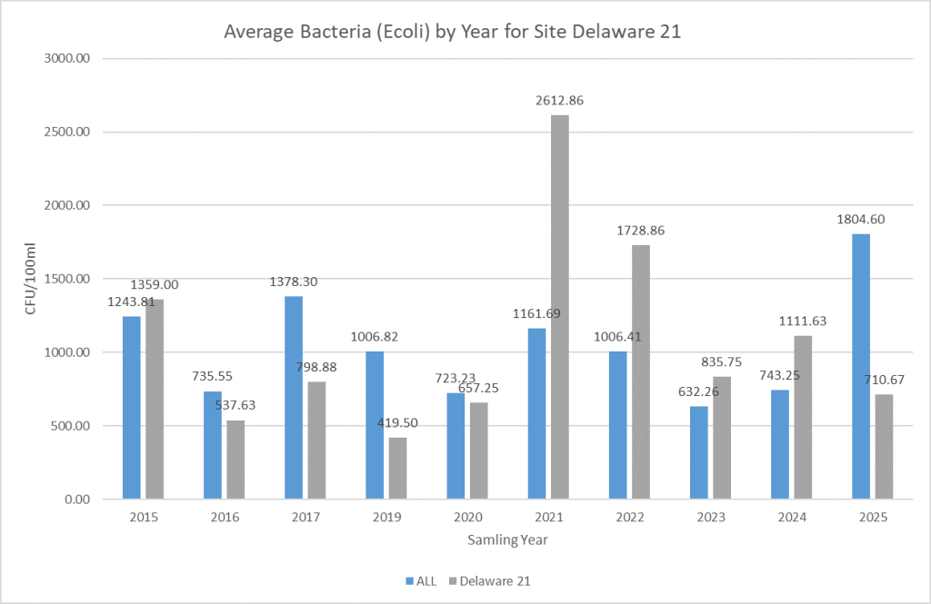
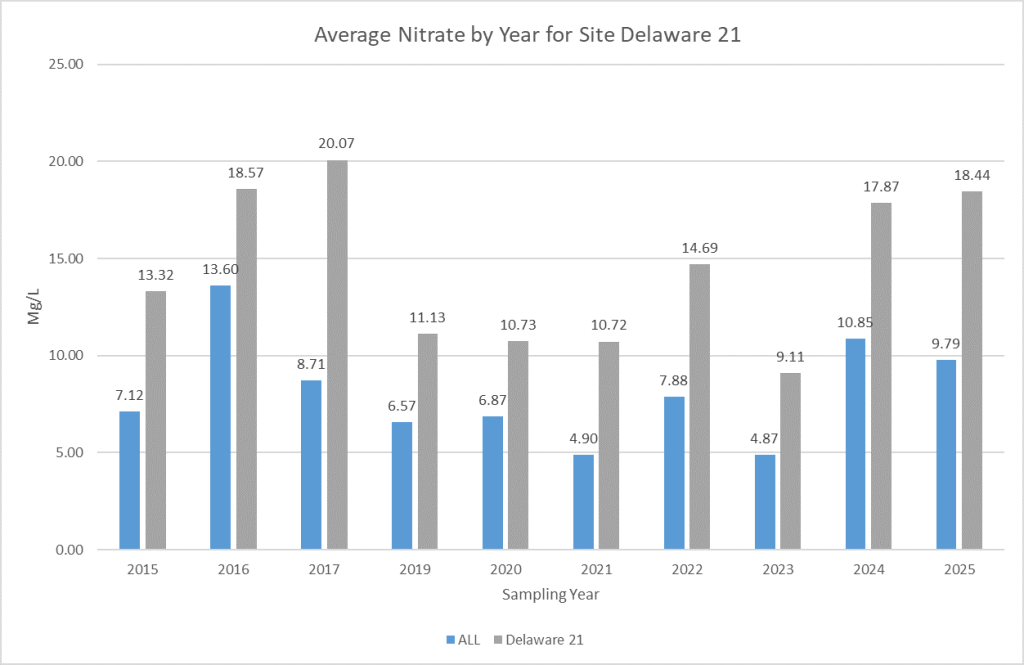
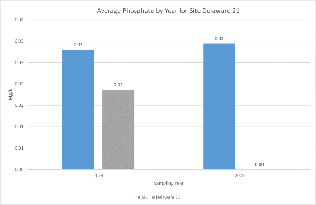
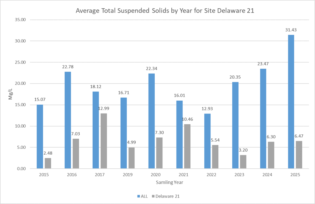
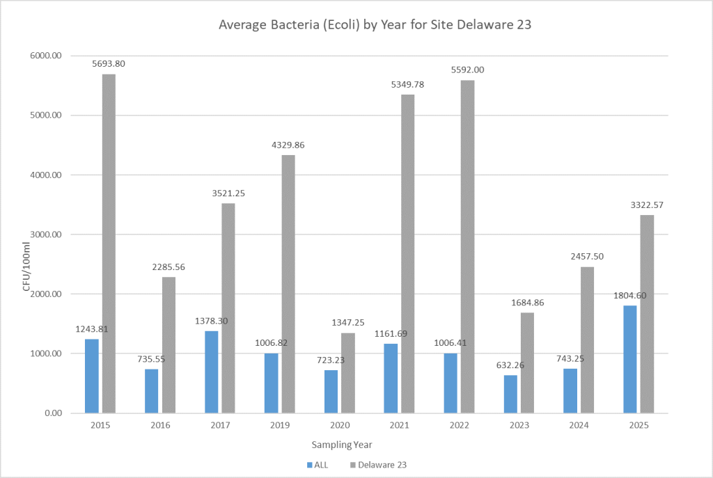
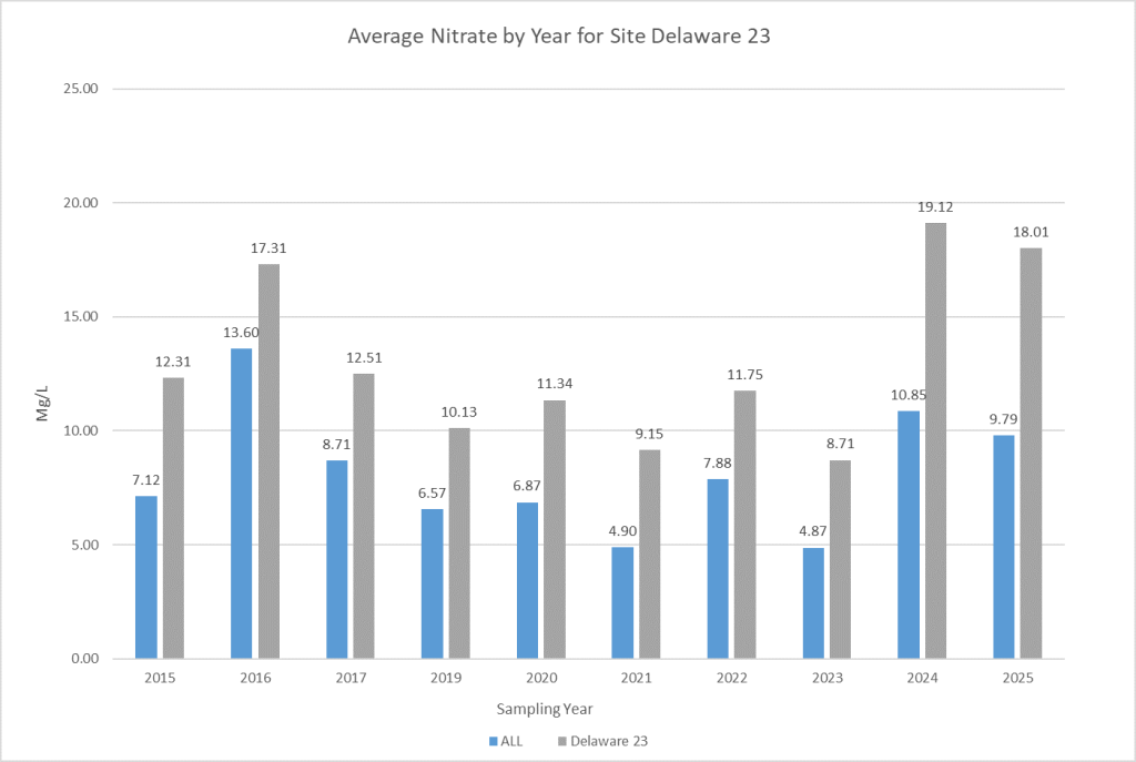
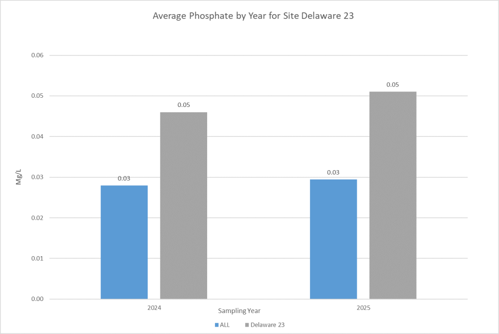
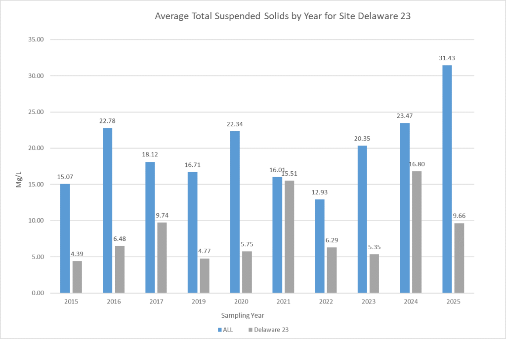
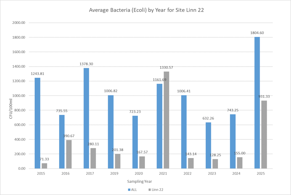
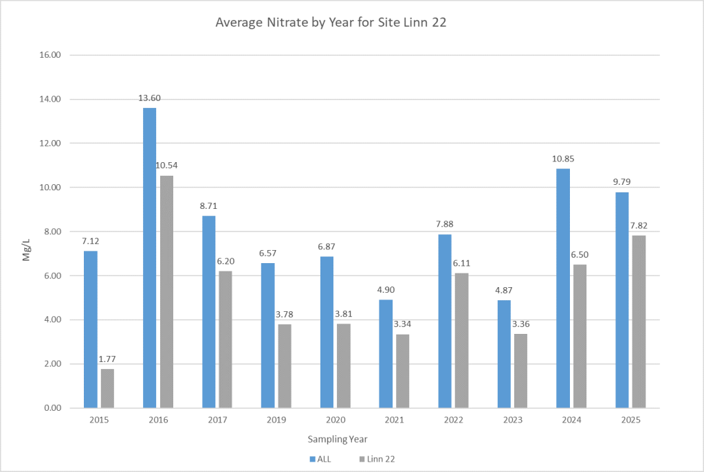
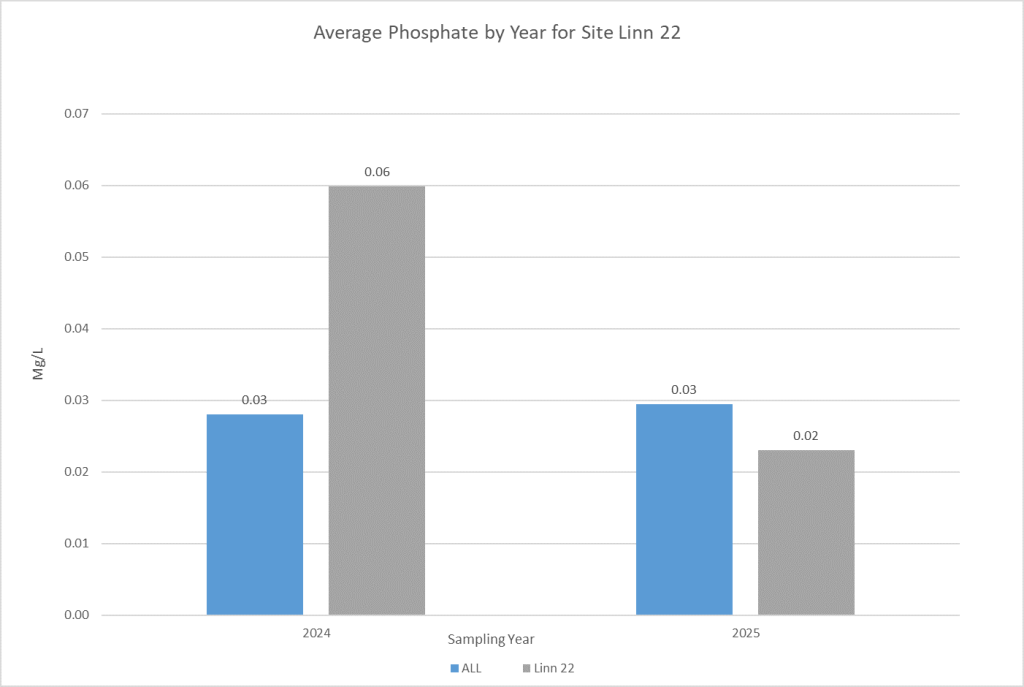
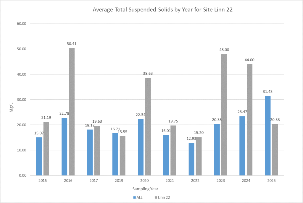
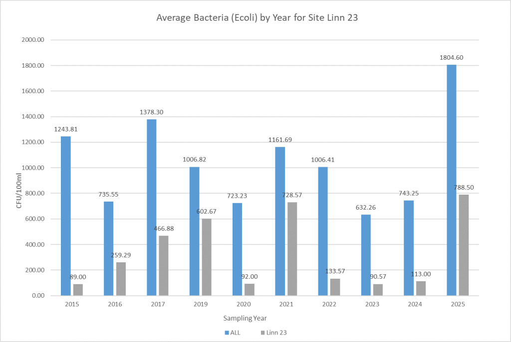
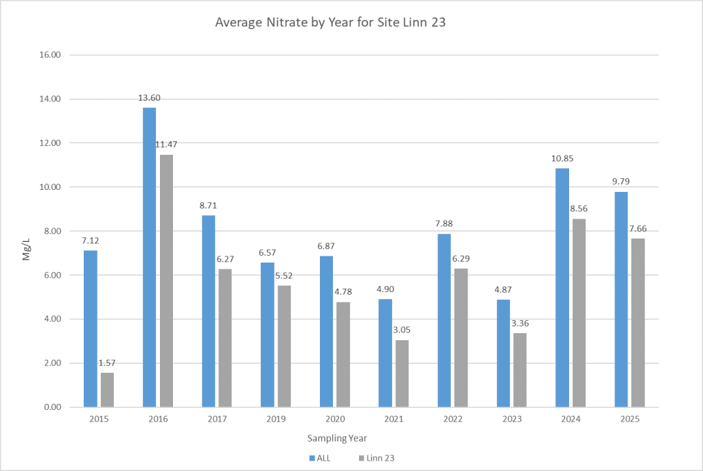
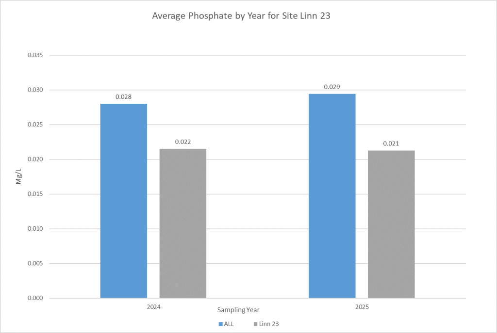
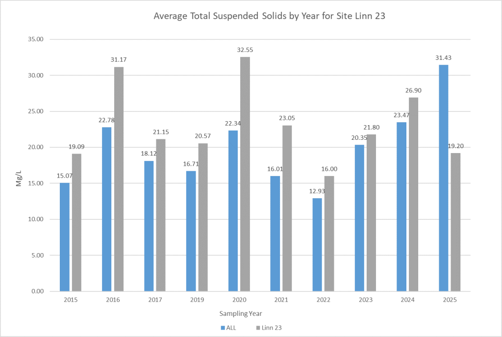
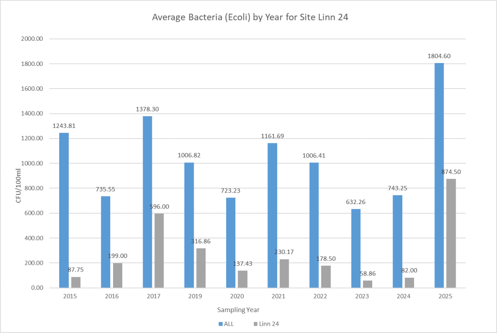
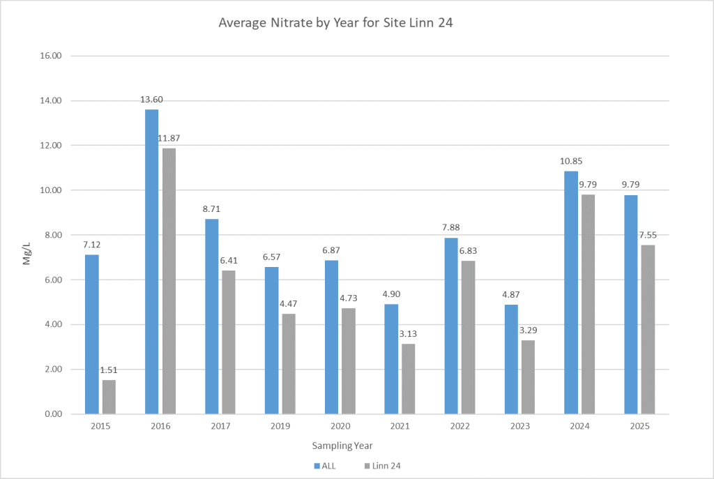
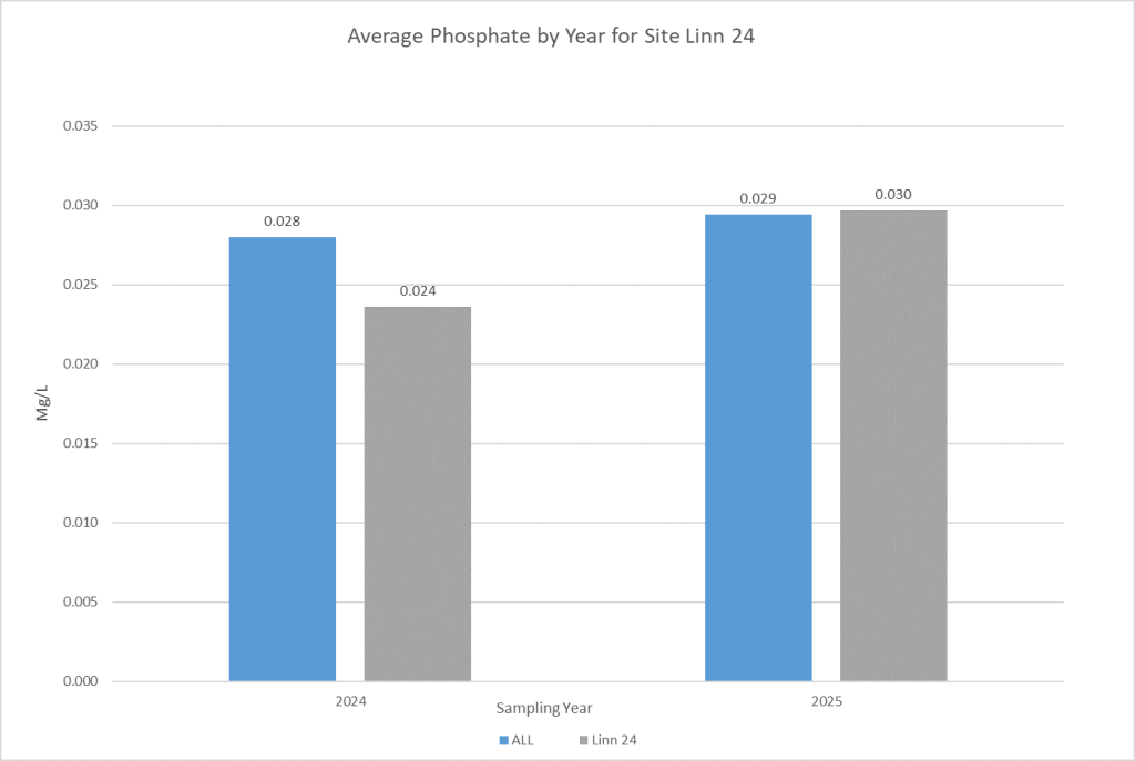
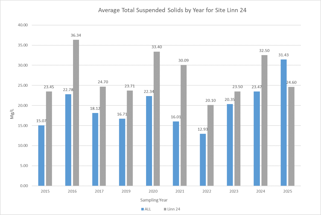
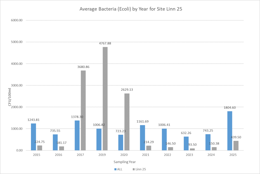
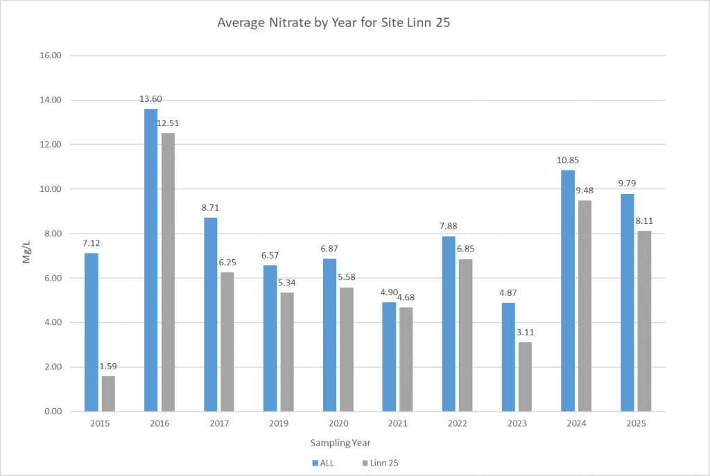
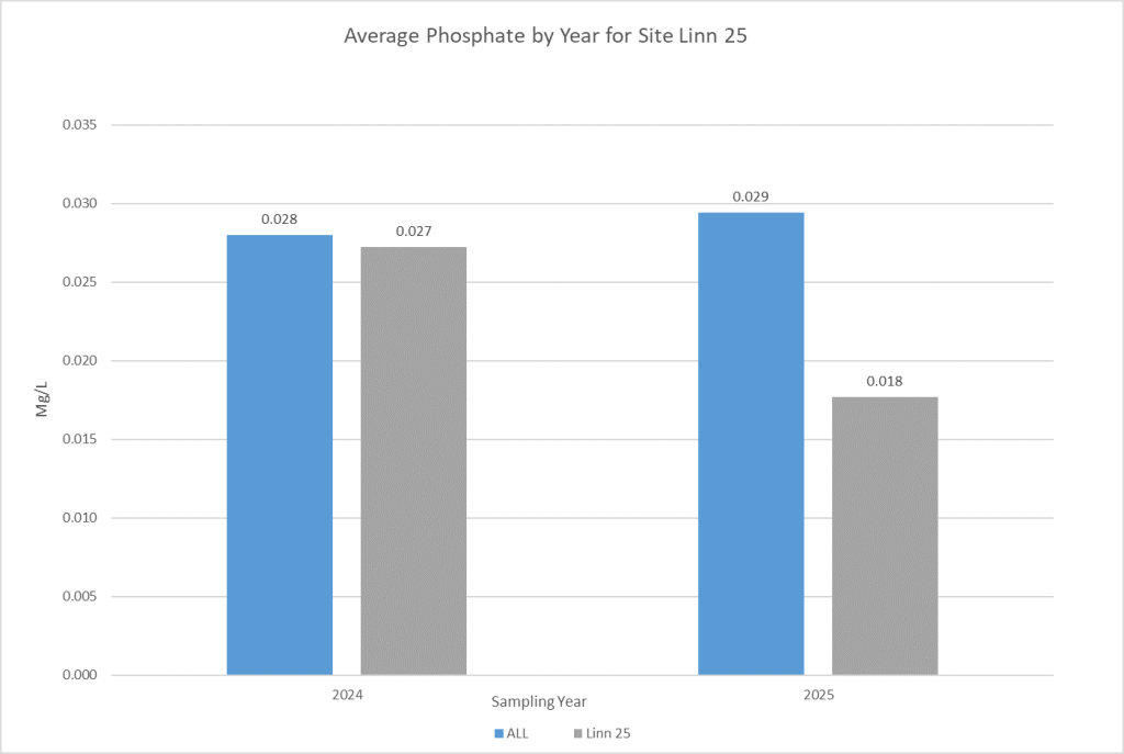
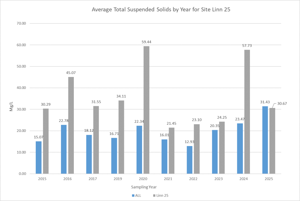
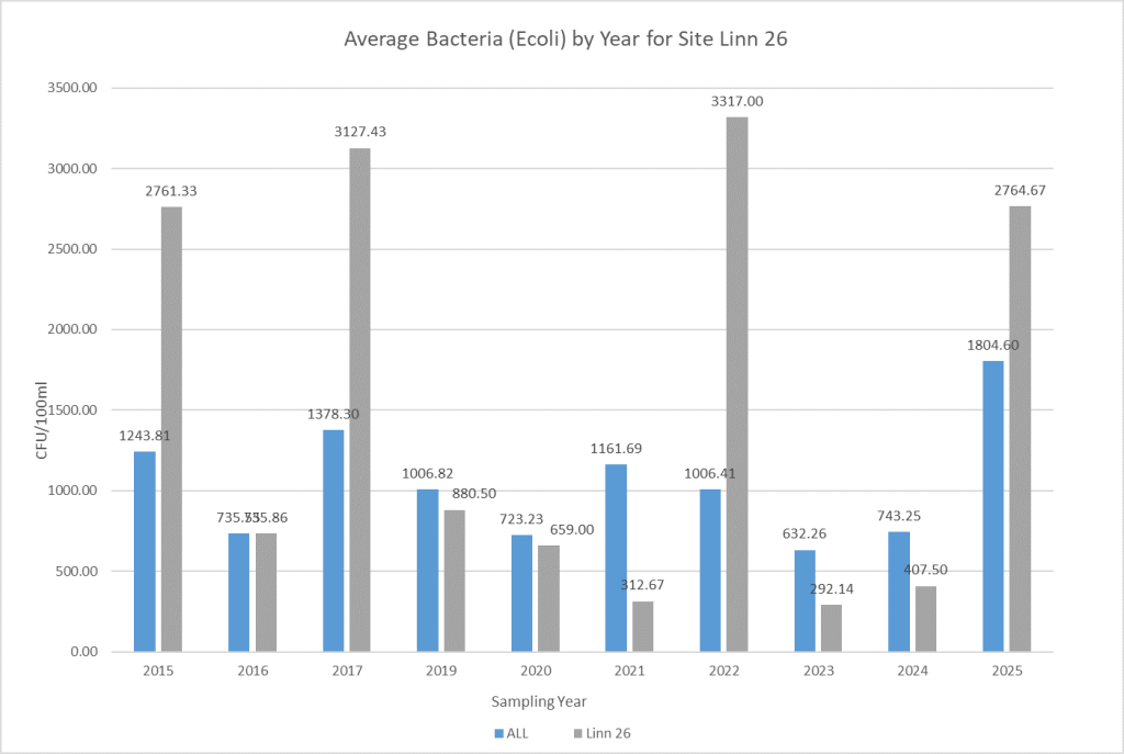
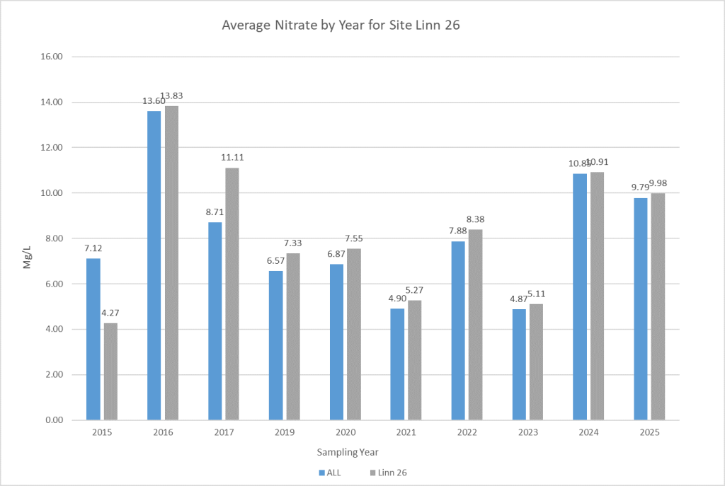
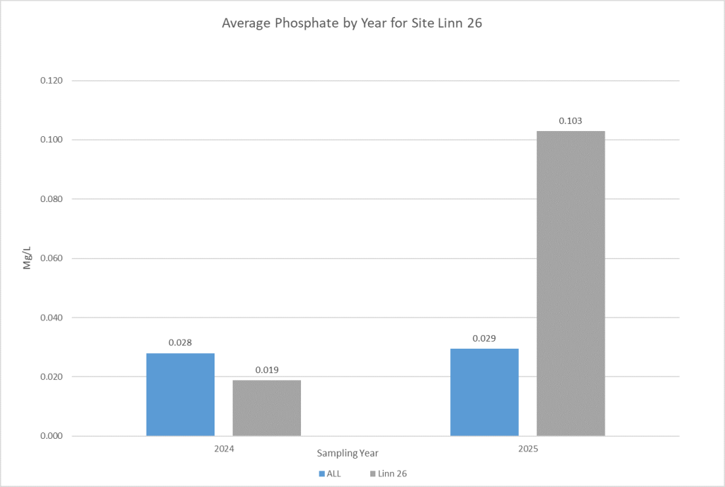
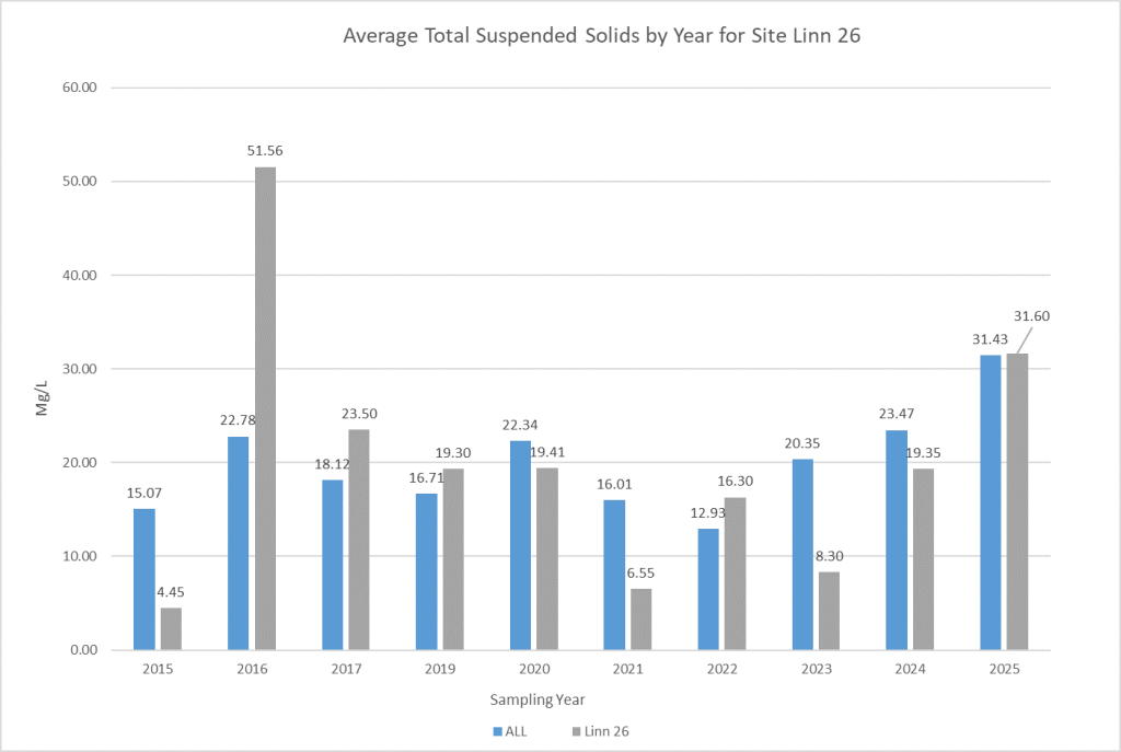
Click on the site of interest to explore nitrate, phosphate, total suspended solids, and bacteria data for that site. The tables associated with each site average results from each sampling year compared to the watershed-wide average.