
The Upper Wapsipinicon River (UWR) Watershed is a long narrow watershed that is divided by many political boundaries. It encompasses small portions of 11 Iowa counties, as well as a portion of one Minnesota county. All or portions of 27 incorporated communities, 16 of which are located on or adjacent to a stream or river, and 17 unincorporated communities/villages, are also located within the watershed boundaries. In part because of the inherent political division of the watershed, and in part because the majority of political entities in the watershed only have a very small portion of the watershed within their boundaries, very few subwatershed projects have ever been implemented to build watershed identity or develop plans. Before formation of the UWR WMA, neither the political entities, nor the watershed residents, had worked together to understand their watershed, set goals and strategies, or to take collective action.
Formation of the UWR WMA changed the dynamics of the watershed by building connections and partnerships between local, state, regional and federal partners. Perhaps even more importantly, it began to build watershed identify and provide a forum for collective thought and action. Funding from a Disaster Resilience Grant provided the financial and technical resources that the UWR WMA needed to engage watershed residents in planning. To maximize the unique opportunity that the grant provided, community engagement and planning was designed to build watershed identity and provide opportunities for watershed residents and community leaders to be involved through various engagement strategies. Implementation of strategies by the UWR Watershed Management Authority Board with assistance from the Northeast Iowa RC&D Planning Team were maximized through the support provided by a diverse team of local, regional, state and federal experts associated with the Iowa Watershed Approach, but ultimately the engagement encouraged local residents and leaders to think, plan and act.
The resulting UWR Watershed Resiliency Plan reflects diverse engagement and input with the hope that it will inspire partners from across the watershed, including public and private residents and organizations from multiple counties, communities, and villages. It also details the ideas and actions that local residents and leaders feel can be implemented and will make a difference.
Several meetings were held in the UWR Watershed, as described below. The meetings were designed, structured and implemented to gather input from Watershed residents, including producers, community members, and partners. Research, information, and in some cases maps and diagrams were presented, and then attendees were asked to consider the information and provide input about what should be done to achieve watershed resiliency. Public participation was exceptional and input was specific, achievable, and measurable. Participants conveyed an understanding of the UWR Watershed, water quality, flooding, conservation issues, and a desire to participate in the implementation of strategies. Their knowledge, input, and engagement set the foundation for successful implementation of the UWR Watershed Resiliency Plan.
At the UWR WMA Board’s request, Northeast Iowa RC&D, the Iowa Flood Center, Iowa Economic Development Authority and other partners engaged watershed residents and gathered input for the Plan at UWR WMA Board and committee meetings, public meetings held throughout the watershed, through focus group and technical meetings, at community planning meetings and through community planning tours, on websites, through partner meetings, and through UWR Watershed and other surveys. All of these efforts informed the planning in some manner, and each is discussed briefly below.
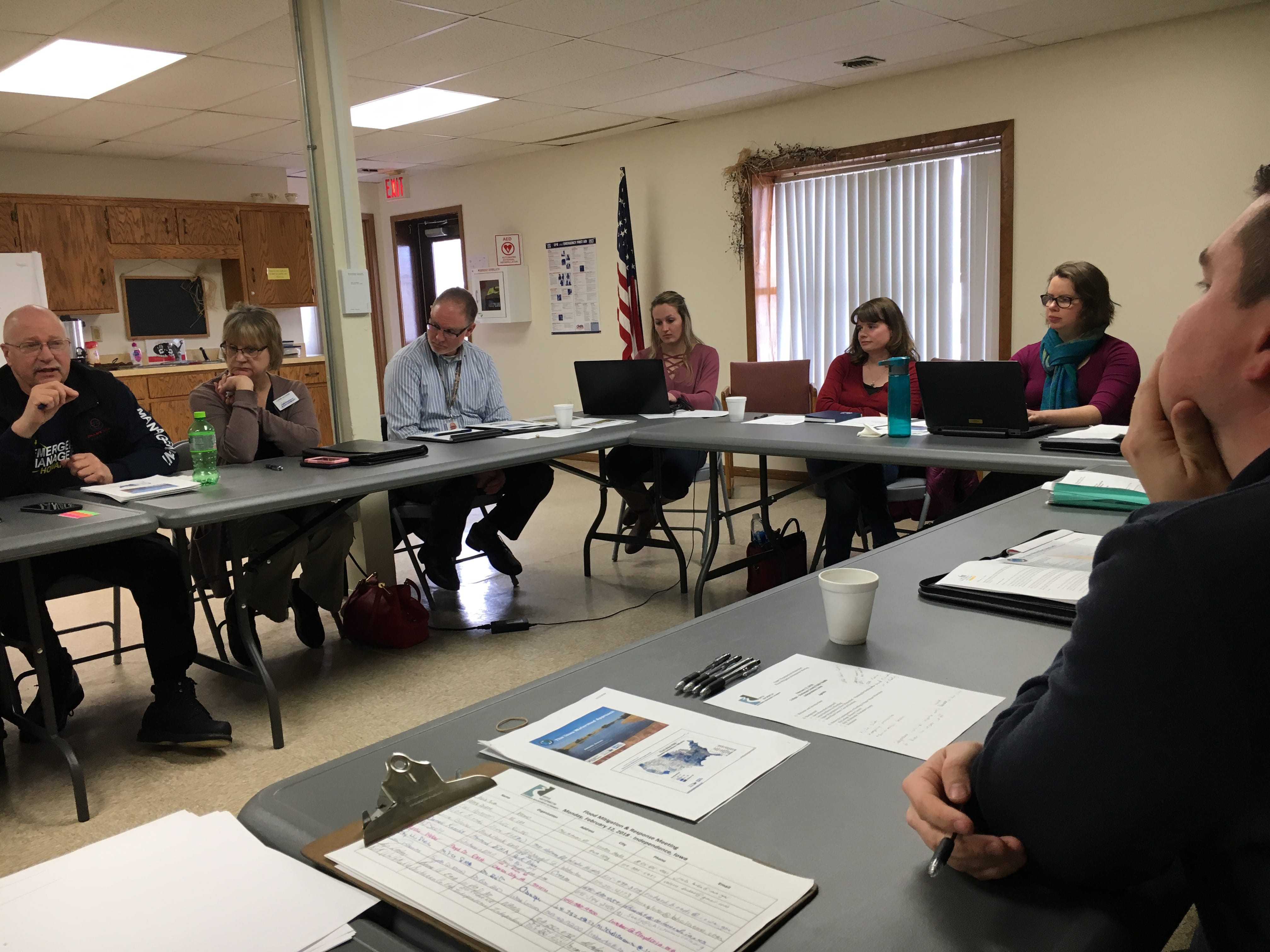
UWR WMA Board Meetings
The UWR WMA Board held open public meetings quarterly throughout the planning process. Information about these meetings was posted before each meeting by each participating WMA member. Research, analysis and relevant information was presented to attendees before and/or after each of the WMA Board meetings. This included information/presentations from the Iowa Flood Center Resiliency Team, IIHR-Hydroscience and Engineering, the University of Iowa Center for Evaluation and Assessment (CEA), Northeast Iowa RC&D, the UWR WMA Project Coordinator, Iowa Farm Bureau, Iowa State Extension, NRCS, U.S. Army Corp of Engineers, UNI Tallgrass Prairie Center, Iowa DNR, Iowa Geological Survey, IDALS, Coe College, Iowa Homeland Security & Emergency Management, WMA members, and others. Attendees were asked questions and were invited to ask questions and provide verbal input regarding the presentations, the process, or any related topic.
Public Meetings
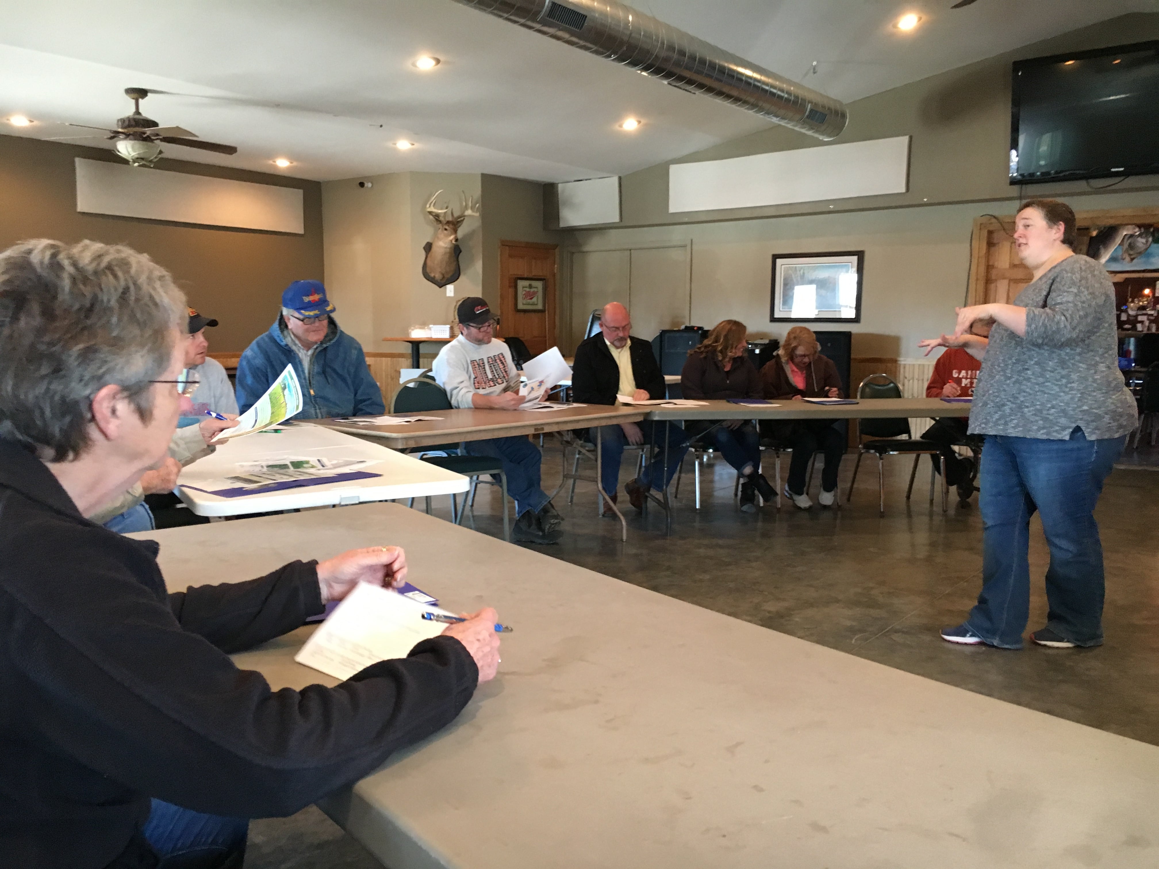
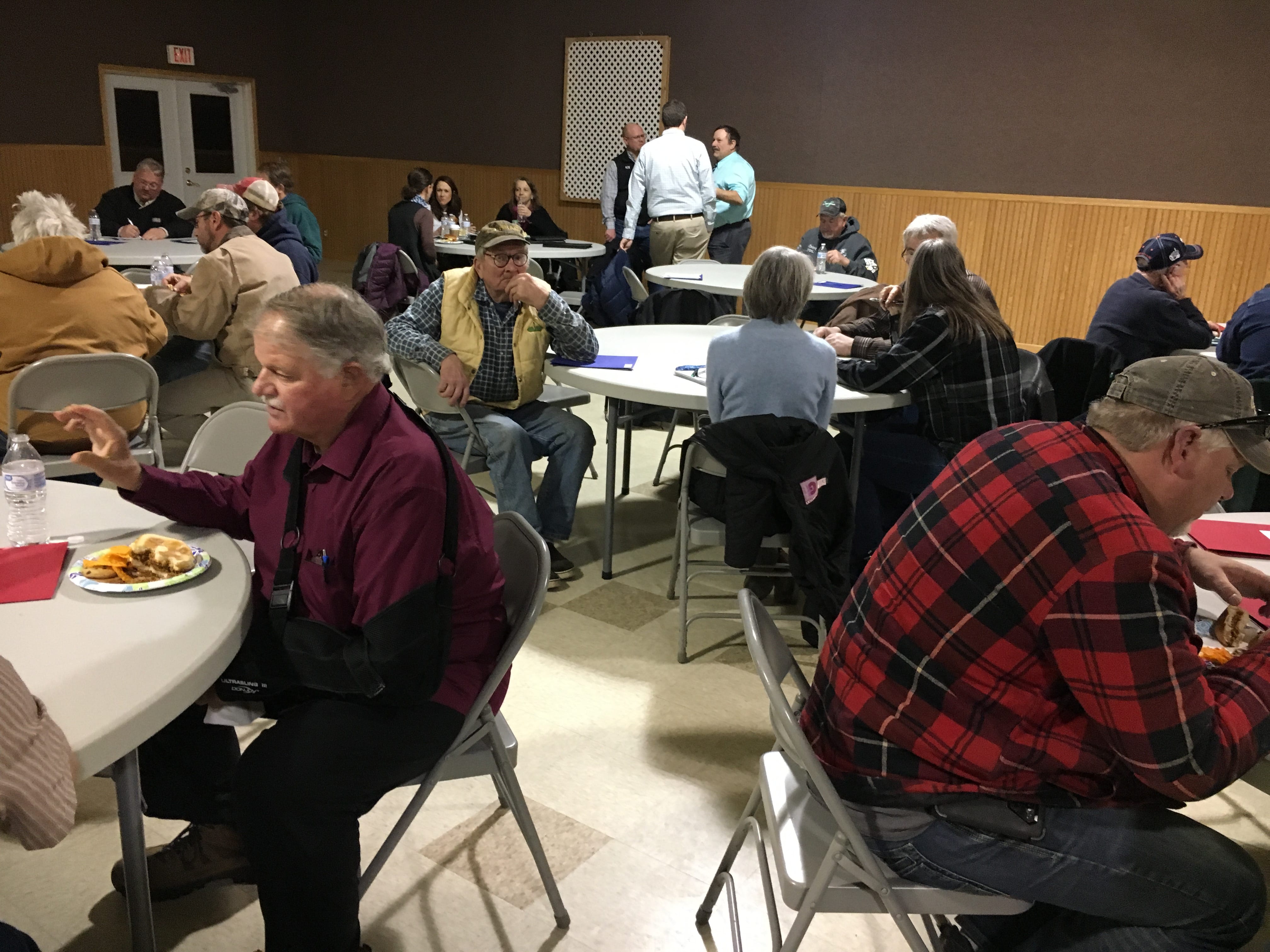
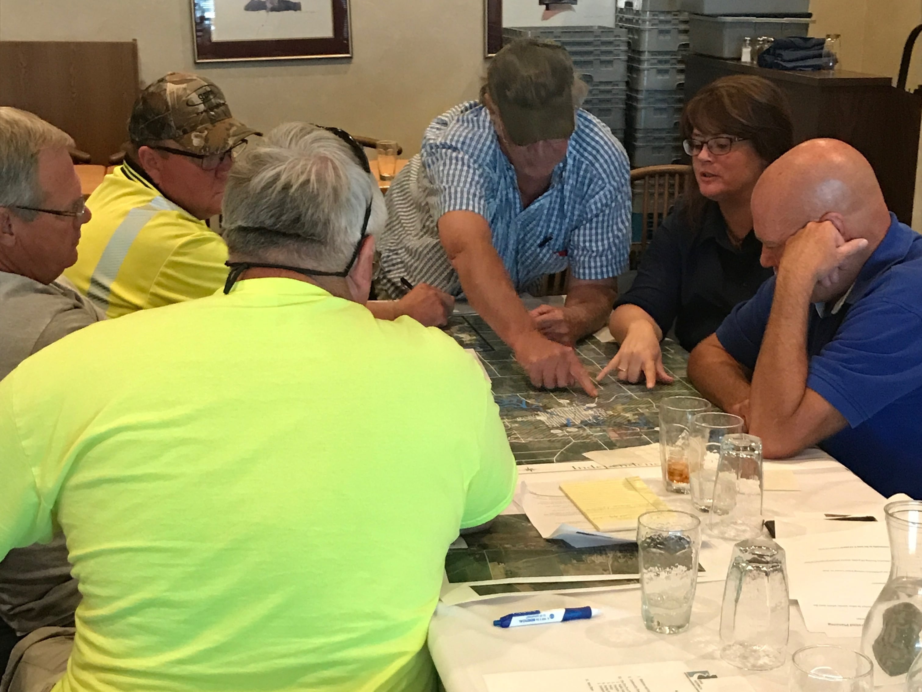
The Northeast Iowa RC&D UWR WMA Planning Team hosted four public meetings in November and December of 2017. More than 40 people attended with approximately 20 attendees in Independence (Buchanan County), 5 in New Hampton (Chickasaw County), 10 in Riceville (Howard/Mitchell County) and 20 in Tripoli (Bremer County). Participants included conventional crop and livestock farmers, local food producers, landscapers, city councilors, county supervisors, city staff, conservation professionals, rural landowners, urban residents, community leaders, teachers, business owners, state policy-makers, and other watershed residents. The meetings were publicized via local newspapers, radio stations, and multiple partner websites. Postcards about the meetings were sent to watershed residents who had expressed interest, as well as partnering organizations and agencies.
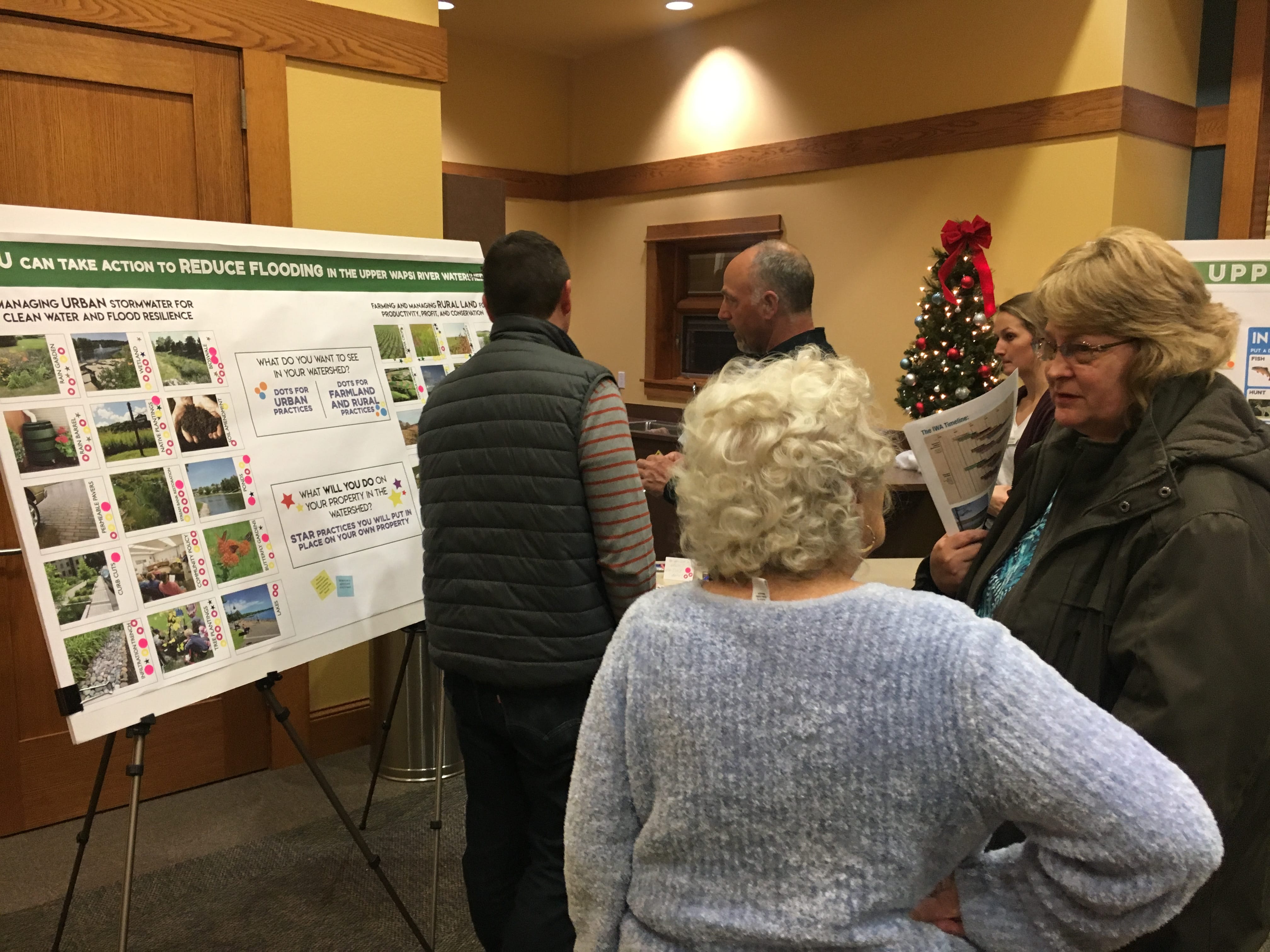
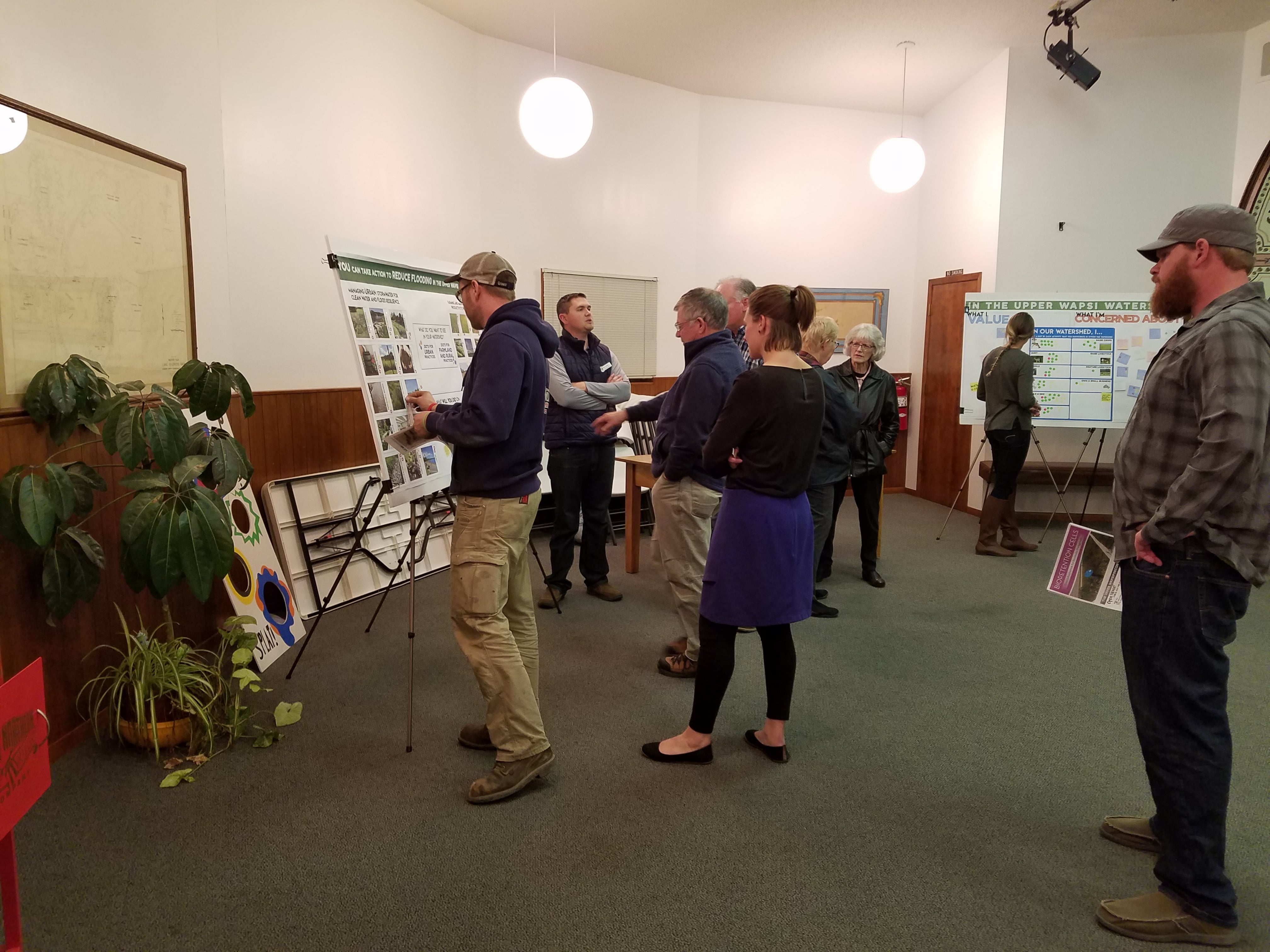
The meetings were structured for maximum input. There was no formal presentation delivered. Meeting attendees were welcomed at the facility entrance and encouraged to participate and provide input at each of five stations. Large interactive posters were set up at each of the stations to communicate research and information about the characteristics of the watershed, the Iowa Watershed Approach and watershed planning. Northeast Iowa RC&D UWR WMA Planning Team members, WMA Board members and/or WMA partners were stationed at each poster to explain the poster content, and encourage participants to provide written input. Attendees were specifically invited to share their concerns and tell planners what they valued in the Upper Wapsipinicon River Watershed. They were asked to consider and convey what kinds of activities they participate in within the UWR Watershed, from agriculture to recreation. One of the posters featured a series of urban and rural conservation practices that could be used to reduce flooding and improve water quality. Participants engaged in conversation about the different practices, were asked which practices they would like to see implemented in their portion of the watershed, and were asked to physically indicate which practices/strategies they would implement on their own land or be supportive of implementing in their own community. Some also expressed their views on what they thought the goals and benchmarks for success should be.
WMA Committee Meetings and Issue Input
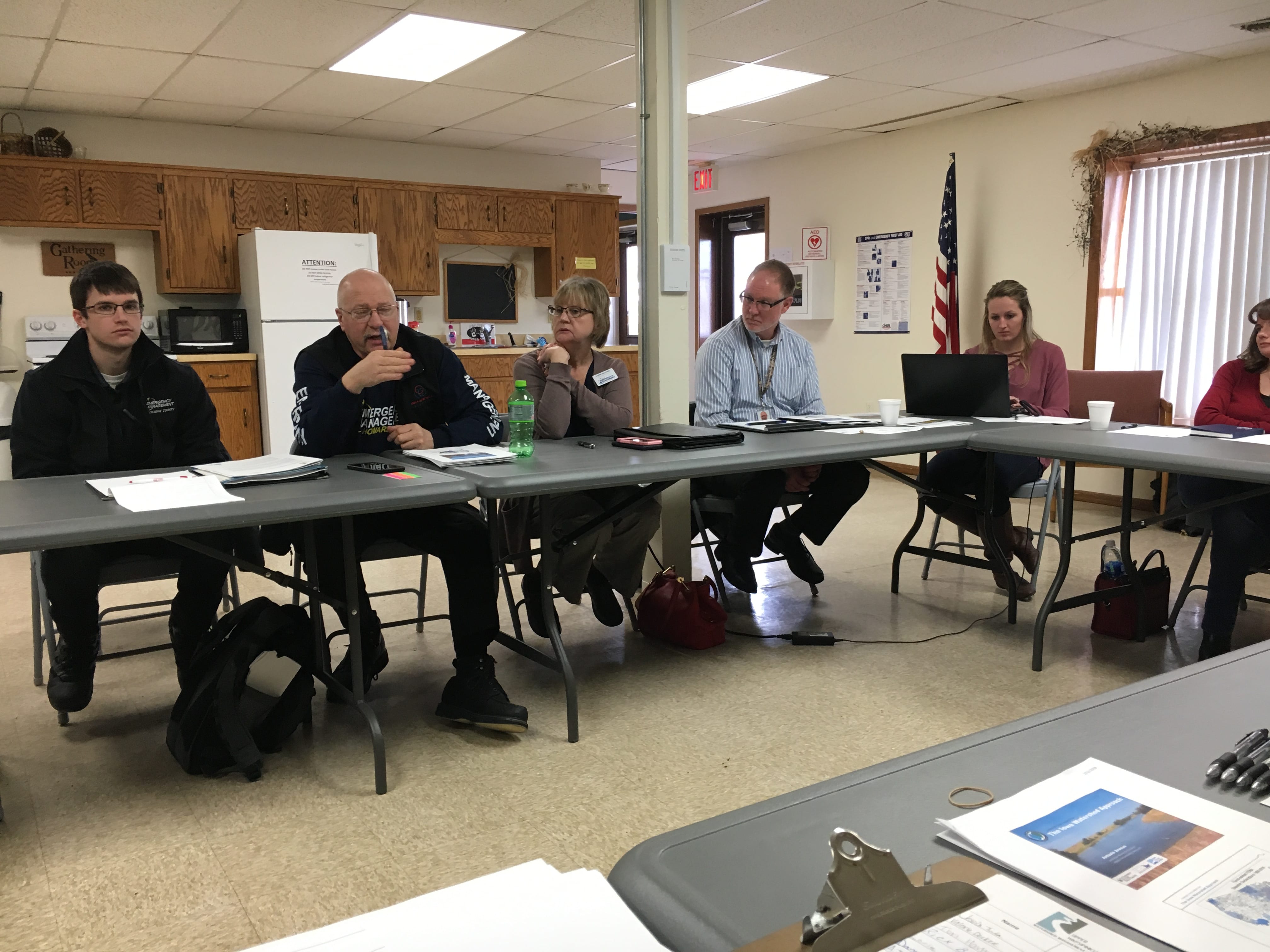
The Northeast Iowa RC&D UWR WMA Planning Team hosted WMA Committee meetings that brought together specific subgroups of the WMA to provide input and recommendations for the Plan. These meetings were by invitation only and included very specific, facilitated technical presentations and discussion, as well as facilitated group decision-making and recommendations.
The UWR WMA Community Committee, which included one or more representatives from several member communities, was the largest of the groups that met to provide input and recommendations for the WMA Board regarding planning and projects within their jurisdictions. They met several times in Independence. The meetings provided opportunities for attendees from multiple communities to share their successes and challenges with regard to specific strategies and projects. The Northeast Iowa RC&D UWR WMA Planning Team also worked via emails and calls with the members of the UWR WMA Public Relations/Communications Committee, who, at the request of the full UWR WMA Board, provided more detailed input and review of the education and outreach components of the Plan.
In partnership with the Iowa Watershed Approach Resiliency Team and the Northeast Iowa RC&D UWR WMA Planning Team also met with a focus group comprised of twenty people. The specific history and consequences of flooding in the UWR Watershed were presented and discussed. Participants included eight County Emergency Managers from the UWR Watershed, two Iowa Homeland Security staff, city and county emergency response personnel, the UWR WMA Coordinator and others. The group discussed local flood-related emergency response challenges and considered emerging opportunities for collaboration that could help mitigate future flooding and flood impacts.
The UWR WMA Technical Committee provided detailed input and recommendations for final measurable outcomes in the plan, as related to the goals and strategies that had been approved by the full WMA Board. This committee was open to all members of the WMA Board. Nine participants considered the watershed characteristics, analysis, surveys, local input, as well as recommended state and federal guidelines, before making recommendations to the full UWR WMA Board. State watershed, emergency management and other experts also attended to inform decision making. All the recommendations made by this committee were adopted by the UWR WMA Board.
In additional to group meetings, the Northeast Iowa RC&D UWR WMA Planning Team met with and discussed specific issues and gathered input through technical conversations with subsets of like professionals such as county engineers, geologists, city officials, public health officials, state partners and others, to specifically gather expert opinion regarding the history of the watershed, past projects, the impact of flooding, landowner relations, potential implementation challenges, current and emerging conditions within the watershed, and other topics. Some of these watershed partners provided data and information that was directly incorporated into the plan while others informed plan content.


Landowner Meetings/Forums
The UWR Watershed Coordinator, and the Northeast Iowa RC&D UWR WMA Planning Team held two meetings for landowners in the HUC 12 watersheds the UWRWMA selected for HUD-funded flood reduction implementation projects. These meetings in Brandon and Quasqueton were attended by more than 20 landowners, who came to learn more about applying for cost-share to have flood reduction practices built on their land. Short surveys were distributed to gather input from the attending landowners. Landowners in the targeted sub watersheds shared their water management concerns, and talked about the type of practices they could imagine implementing on their land. They ultimately recommended prioritizing one-on-one, focused, targeted outreach to landowners who own specific properties in the watershed that have been modeled to be priority locations for maximization of implementation dollars. They also indicated concern over flooding, water quality and crop damage, and said financial assistance would help them overcome barriers to implementing more conservation practices on their land.


Community Planning Meetings and Partnerships
The UWR Watershed encompasses all or portions of 27 incorporated, and several unincorporated, communities; whose populations range from 117 residents of North Washington to 6,415 residents of Oelwein. Fifteen of those communities participate in the UWR WMA. In addition to the UWR WMA Community Committee meetings, all of the communities who participate in the UWR WMA were invited to attend one of two UWR Community Planning Meetings. Representatives from 9 of the communities attended at least one of the two Community Planning Meetings, held in April and August of 2017, including Aurora, New Hampton, Riceville, Independence, Winthrop, Quasqueton, Tripoli, Readlyn, and Dunkerton. At the meetings, the Northeast Iowa RC&D UWR WMA Planning Team presented information about urban conservation, facilitated discussion with and between community leaders about the key elements of community-based planning, and gave examples of practices and programs communities could use to mitigate flood risk, improve stormwater management, beautify, and increase watershed resilience.
UWR WMA community representatives then went back to their communities and formed “Community Teams” that consisted of 2-7 team members. Team members from each community varied but included some combination of city staff, city councilors, their mayor and/or city administrator, park and recreation personnel, community facilities partners and/or other interested community members. These individual Community Teams were invited to work with the Northeast Iowa RC&D UWR WMA Planning Team to take a more in-depth look at their existing and future urban stormwater management and identify potential projects. They were provided information on potential stormwater BMPs, given examples of the ways in which similar communities in Iowa were utilizing the practices for stormwater management, community beautification, and tourism & economic development, and advised about various technical and financial assistance opportunities.
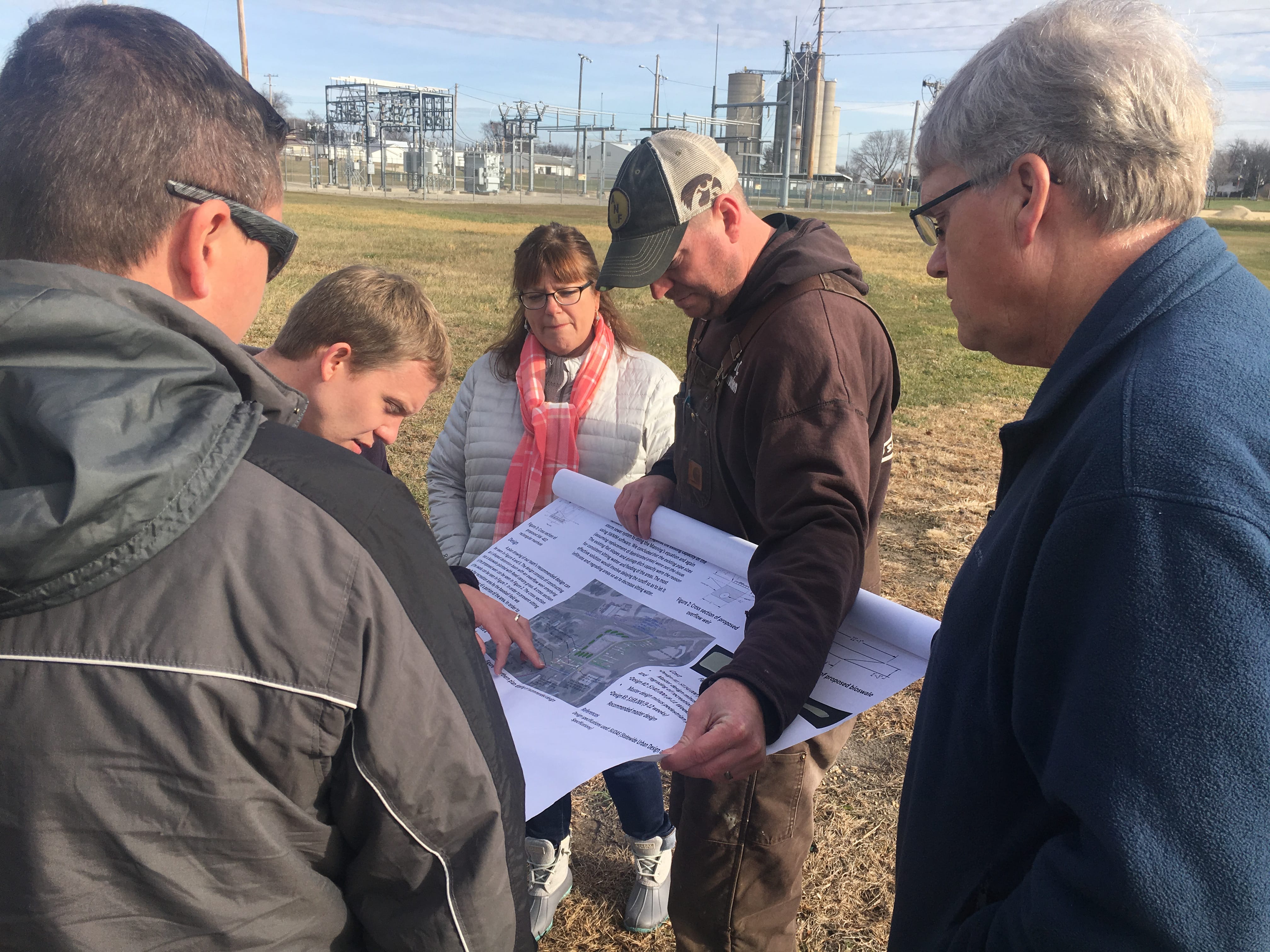
The Northeast Iowa RC&D UWR WMA Planning Team also created and provide “flow” maps for participating Community Team. These maps showed the Community Team members how storm water naturally moved into, through, and out of, their community. Areas of the community with storm water runoff issues were identified on the maps. Community planning and development was considered, as well as how stormwater BMPs could be utilized to both address water concerns and augment other community initiatives.
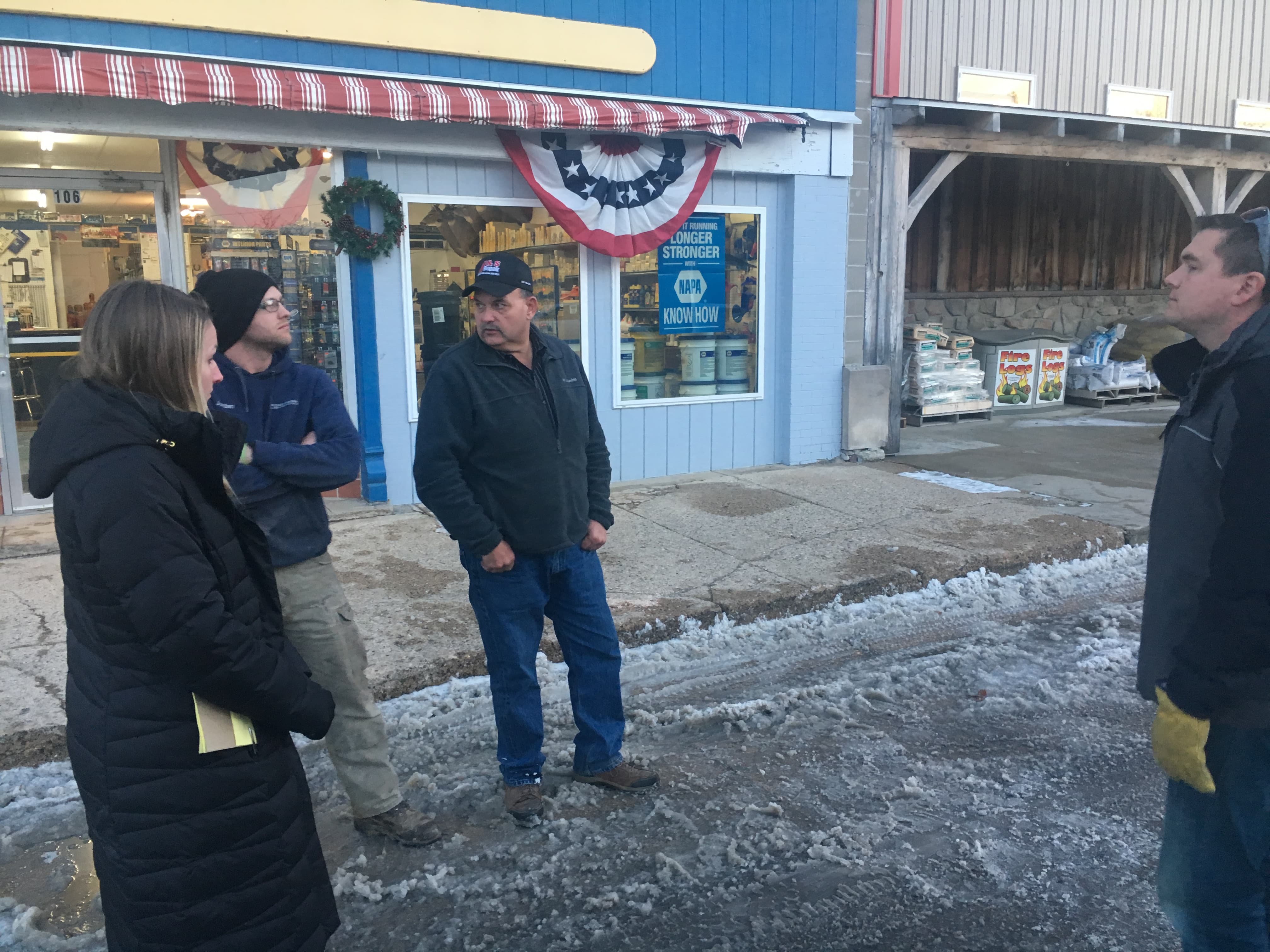
Any community that formed a Community Team was also invited to schedule community walk-through meetings with the Northeast Iowa RC&D UWR WMA Planning Team, during which community leaders and planners could tour their community to identify and target problem areas, areas slated for development, and map potential projects. Several UWR WMA communities took advantage of this opportunity.
The Northeast Iowa RC&D UWR WMA Planning Team also helped interested Communities take advantage of a new Partnership opportunities.
- The RC&D UWR WMA Planning Team worked with interested communities to submit applications to the University of Iowa College of Engineering to receive free preliminary engineering from U of Iowa engineering students. At least four of the communities in the UWR WMA secured and utilized these free engineering services, Dunkerton, Winthrop, Independence and Elma. The assistance informed the planning and helped the communities better understand specific stormwater runoff issues and potential solutions. As a result of the assistance, some of the communities moved forward with more extensive community planning and engineering, some realized that different stormwater runoff solutions might be more appropriate than what they originally planned, and others identified previously unknown community stormwater infrastructure and system issues that needed to be addressed.
- The RC&D worked with communities that qualified for, or were expected to qualify for, State Revolving Loan Sponsored Project Funding and/or the IDALS Water Quality Initiative Grants, helping them understand how to utilize those funding sources and/or developing SRF urban stormwater runoff plans. This included Winthrop and Riceville. Readlyn developed a project with the assistance of a private consultant.
- The University of Iowa Resiliency Team is currently partnering with the RC&D UWR WMA Planning Team to conduct a Flood Resilience Case Study with community members from Quasqueton. The study is intended to help develop a better understanding of the current social vulnerability and resiliency issues related to flooding and water quality, identify strategies, opportunities, and partnerships that are most likely to reduce the vulnerability and increase the resiliency of the most vulnerable populations, and engage the community in the development and implementation of an Action Plan.
Community Survey
During the planning process a survey was sent to community leaders within the Upper Wapsipinicon River Watershed. The goal of the survey was to gather information about what cities currently had for stormwater management and what they would like to do in the future to better manage their storm water runoff. The survey was sent to the 14 participating UWR WMA member communities. Five communities responded, Tripoli, Dunkerton, Quasqueton, Frederika, and Winthrop. Out of the five communities that responded, three of them do not include stormwater management as part of their city’s comprehensive plan or any other community plan. UWR WMA communities were also asked which urban stormwater management practices they would be interested in implementing in their community. All of the five responding communities expressed interest in rain gardens and bioswales. Respondents also expressed interest in implementing community stormwater policies, such as stormwater ordinances, or implementing a cost-share program for stormwater projects on private property.
Websites
Northeast Iowa RC&D developed an UpperWapsi.org website for the UWR WMA Board before the planning began. Throughout the planning process, the RC&D UWR WMA Planning Team posted information about the UWR WMA, the planning process and related activities. Information about specific stormwater practices, upcoming meeting notices, information and content about and from past WMA and public meetings, maps and ongoing research, press releases, and opportunities for public input. Information was also posted on the Northeast Iowa RCD Facebook page. The public was encouraged, through media, at meetings and by personal referral, to inform the planning, ask questions, and provide input, throughout the planning process. Partner websites also included information about the project, including IowaFloodCenter.org ; IowaWatershedApproach.org ; IowaEconomicDevelopment.com; IowaDNR.gov and others.
Partner Meetings
Northeast Iowa RC&D UWR WMA Planning Team worked with the UWR WMA Board members to maximize community meetings, partner meetings and nonprofit activities, to inform planning and gather feedback from the public. These planning activities included giving general and specific presentations and facilitating discussion at several local and community meetings and venues. This included a presentation at the RC&D’s annual Partner Appreciation BBQ, which was attended by Supervisors, Commissioners, conservation and economic development professional and legislators from throughout Northeast Iowa. It also included a presentation with the Buchanan County Conservation Board to interested producers, and presentations to producers at UWR WMA meetings organized by the UWR WMA Coordinator.
Written Surveys
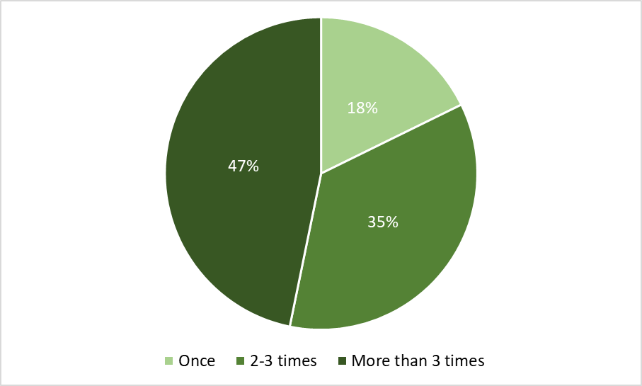
The Northeast Iowa RC&D UWR WMA Planning Team developed, distributed and analyzed an UWR Landowner Survey in July 2017. The goal of the survey was to raise awareness among rural and urban watershed residents and gather statistically valid input for the UWR WMA Plan. It was distributed to 1,300 landowners and 251 were returned, a 19% return rate. Recipients were selected by computer at random from county parcel data. Survey questions were related to landowner experiences and attitudes concerning flooding and water quality. Findings were presented to the UWR WMA Board at a regular UWR WMA Board meeting and posted on the UpperWapsi.org website. Some of the major findings include over 40% of survey respondents live over 30 miles from the UWR Watershed (they are absentee landowners). Over 25% of survey respondents reported having been “directly impacted by flooding within the last 5 years”, 85% agreed that flooding “is a problem in the Upper Wapsi River Watershed”, and 79% of farmers and farmland owners indicated they are “interested in receiving conservation planning assistance, with the potential for funding for adopting conservation practices on their land”. The final goals, objectives and strategies included in this plan were heavily influenced by the survey results. The full results of the survey are available at UWR WMA Landowner Survey.