Soil is one of the most significant components of the UWR Watershed, impacting ground and surface water quality, agricultural productivity, environmental stability, economic vitality, and overall watershed health. The depth, type, health, natural and artificial drainage, management practices, slope, biological and chemical makeup, and other characteristics of soil, influence its water holding capacity, infiltration rates, runoff potential, nutrient mobility, erosion, and other functions. Because soil blankets the entire watershed and soil quality can be improved or degraded, soil holds the single greatest potential to reduce or exacerbate flooding, and improve or degrade water quality.
Poor quality, compacted soils hold a minimum amount of rainfall. Conversely, healthy, functioning, stable soils act as a sponge, soaking up rainfall. The water holding capacity of soil increases as the organic matter in the soil increases. USDA NRCS State Soils Scientist Rick Bednarek notes that,
“Healthy soils may hold 16,000 to 20,000 gallons/acre per percent of organic matter. Infiltration is another soil characteristic that can be improved with organic matter and other factors. Soil quality refers to the inherent qualities of the soils, whereas, soil health is related to the more dynamic properties of the soil that change due to management including microbiology, organic matter, etc.”
Soil quality and organic matter can be increased on land in agricultural production by:
- Soil armor
- Minimizing chemical and physical disturbance
- Continuous living roots in the soil
- Maximizing plant diversity
- Integrating livestock
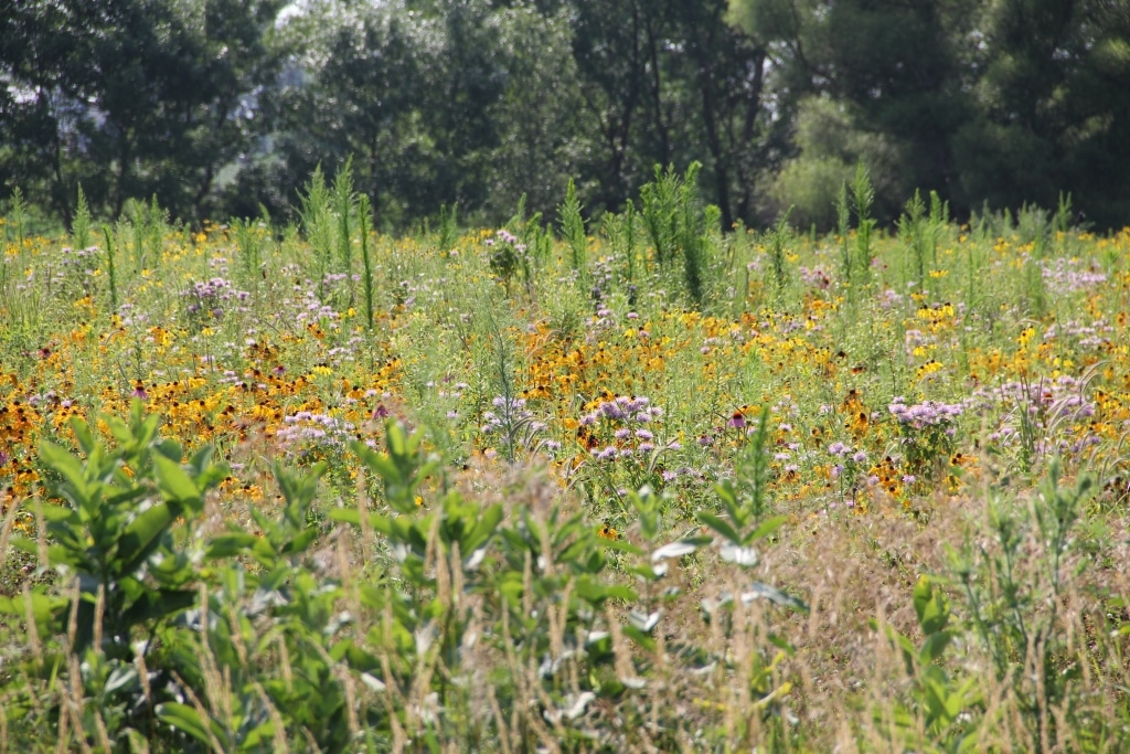
The five tenets of soil health listed above are a replication of the soil health practices of native prairie. Prairies were very diverse, armored the soil, included minimal disturbance, had year-round plant cover, and had large ruminant grazers present. Healthy soils function with high levels of biologic activity which create pores and passageways for water to infiltrate more easily and helps the soil act like a sponge, holding water on the landscape during excess rainfall and keeping moisture available during times of drought. The interactions between plants and biology increase soil stability by creating a sort of glue to help hold soil in place, which limits how easily erosion can occur. Land management strategies, such as the use of cover crops or multi-cropping, controlled traffic, and organic inputs such as manures and composts, can increase soil health. 
Soils in the Upper Wapsipinicon River Watershed are dominated by three main soil types Kenyon, Clyde, and Floyd. The USDA describes the Kenyon, Clyde, Floyd and other soil types, their properties and landscape positions in the Soil Surveys they publish by county. They also provide extensive maps that delineate the locations of each soil type throughout each county. The Soil Surveys are publications of the National Cooperative Soil Survey, a joint effort of the USDA and other federal, state and local agencies. The Soil Surveys are available on-line and provide important information for producers and watershed residents but additional analysis.
Information provided in the Soil Surveys can be analyzed with other data sets to extrapolate information and to target technical and financial assistance to producers.
For example, the Soil Surveys note the Kenyon series consists of very deep moderately well-drained soils. These soils are on side slopes on dissected till plains on the Iowan Surface. They are found on slopes ranging from 2-35 percent. Most areas of Kenyon soils are cultivated, with the primary crops being corn, soybeans, small grains, and legume hay. Clyde soils consist of very deep, poorly and very poorly drained soils. These soils are on nearly level positions, swales and concave drainage ways on inter-confluences on dissected till plains. They are found on slopes that range from 0 to 4 percent. Where artificially drained, Clyde soils are cultivated with the primary crops being corn, soybeans, small grains, and legume hay. Where not artificially drained, Clyde soils are pastured. The Floyd soil series consists of very deep, somewhat poorly drained soils on slopes of 0-5 percent. Most areas with this soil series are cropped in corn or soybeans.
The characteristics of soils are important, but there are additional factors, such as the rise of the land area or percent slope, and the run or length from the top to the bottom of the area or field. These, as well as other site-specific land use and conservation practices, are an extremely important consideration and both influence how the Kenyon, Clyde, Floyd, and other soil groups infiltrate water. For example, although Kenyon and Floyd soils are somewhat well-drained, the greater the slope or the longer the slope, the more potential there is for surface runoff. Severe erosion can occur in fields with slopes greater than 9% if the plant cover is absent or limited but also in larger fields with lower percent slopes. (Effects of Soil Erosion on Soil Properties as Related to Crop Productivity and Classification, USDA,1985). Production methods and management, including cover crops, multi-cropping, no-till, crop residue management, enrollment in conservation reserve programs and implementation of structural practices that slow runoff on steep slopes can all be manipulated positively or negatively as relates to soil health and erosion.
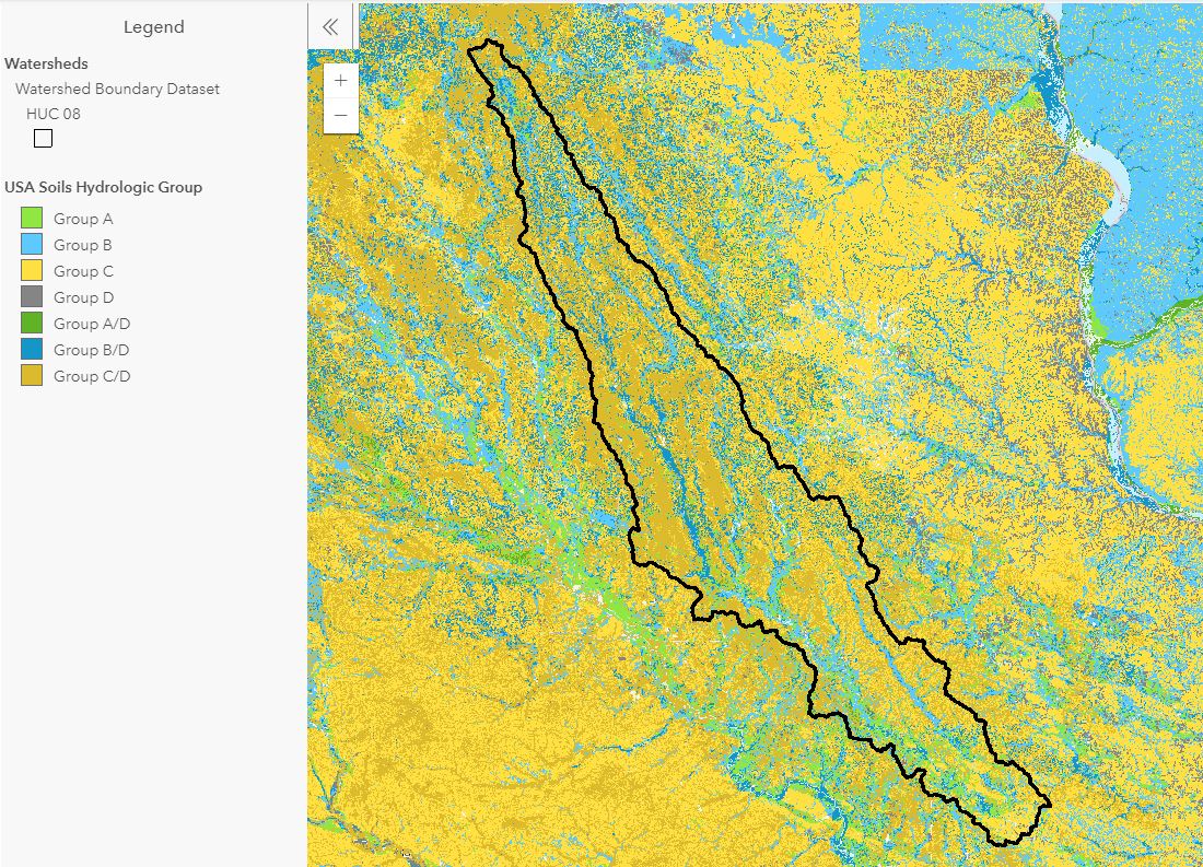
The Upper Wapsipinicon River Hydrologic Assessment, calls attention to the important role that shallow groundwater and soil moisture conditions play in the transformation of rainfall into runoff, noting that high soil moisture and groundwater levels have contributed to flooding in the past. They also reference the Hydrologic Soil Groups that NRCS uses to classify a soil’s runoff potential and the influence the groundwater table has on infiltration, noting the following.
“Soils are classified into four Hydrologic Soil Groups (HSG) by the Natural Resources Conservation Service (NRCS) based on the soil’s runoff potential. The four HSG’s are A, B, C, and D, where A-type soils have the lowest runoff potential and D-type have the highest. In addition, there are dual code soil classes A/D, B/D, and C/D that are assigned to certain wet soils. In the case of these soil groups, even though the soil properties may be favorable to allow infiltration (water passing from the surface into the ground), a shallow groundwater table (within 24 inches of the surface) typically prevents much infiltration from occurring. For example, a B/D soil will have the runoff potential of a B-type soil if the shallow water table were to be drained away, but the higher runoff potential of a D-type soil if it is not. Complete descriptions of the Hydrologic Soil Groups can be found in the USDA-NRCS National Engineering Handbook, Part 630- Hydrology, Chapter 7.”
The majority of the UWR Watershed is a part of the silty and loamy mantles firm till plain. Soils in the central and northern portion of the watershed are mostly poorly drained or somewhat poorly drained. They are formed in thin silty material over loamy till underlain by sedimentary bedrock. Slopes range from gently sloping to very steep. Cropping and grazing on ridge tops and valley bottoms are common. Steeper side slopes are typically wooded. The furthermost southern portion of the watershed contains excessively drained to well-drained soils. This portion of the watershed is made up of broad upland, nearly level to moderately sloping. Erosion is a significant concern with these types of soils.
The central and northern portions of the watershed are made up of hydric to partially hydric soils, defined by the National Technical Committee for Hydric soils as, “soils that formed under conditions of saturation, flooding or ponding long enough during the growing season to develop anaerobic conditions.” The southern portion is made up of non-hydric soils. (Rapid Watershed Assessment, NRCS)
