Watershed News
Next WMA Meeting: TBD Other News
Next WMA Meeting: TBD Other News
County Hazard Mitigation Plans Bremer County Black Hawk County Buchanan County Chickasaw County Delaware County Fayette County Howard County Linn County City Plans Independence Flood Mitigation Element Report Guide: Upper Wapsi Upper Wapsipinicon Education and Outreach Matrix Strategies Survey Results Reference Materials 2012 Ag Census Web Maps, Overview | USDA/NASS Advanced Hydrologic Prediction Service: [...]
What is Source Water? Source Water is the term that is used to define the source or origin of drinking water. Source water can be derived from surface water, such as a river, stream, lake, or reservoir, or it can be from groundwater. The quality of Source Water can be influenced by many natural and [...]
Given the size and scale of the UWR Watershed and the river, where rain falls on the landscape within the watersheds greatly impacts how, or if, river levels are influenced at any particular site along the river. There are many methods utilized by various agencies to gather and monitor past and current weather, river flow and [...]
Goals Improve and Protect Ground and Surface Water Quality Reduce the risk and impact of flooding to social, economic and ecological systems Build Human and Landscape Resiliency Objectives, Strategies, and Actions Objectives, Strategies, and Actions were adopted by the Upper Wapsipinicon River Watershed WMA Board to help them reach their goals and achieve their [...]
Communities in the Upper Wapsipinicon River Watershed Although there are no large urban areas within the Upper Wapsipinicon River Watershed, the watershed does encompass all or portions of 27 incorporated communities that range in size from just over 100 people to over 6,000 residents. There are also 36 unincorporated communities [...]
The ability to analyze various characteristics of any landscape, including the Upper Wapsipinicon River Watershed, using LiDAR, satellite imagery, innovative analytical computer software, and modeling programs has escalated in recent years. The capacity has not only increased in terms of the tools, but also in the availability, time commitment, and ease of analysis, making it [...]
Non-Point Source Pollution Non-point source pollution is caused by rain or runoff carrying pollutants into surface or groundwater. Iowa’s primary pollutants are plant nutrients such as nitrogen and phosphorous from commercial fertilizers used in rural and urban areas. Because much of Iowa is rural, especially the Upper Wapsipinicon River Watershed, the primary sources of nutrients [...]
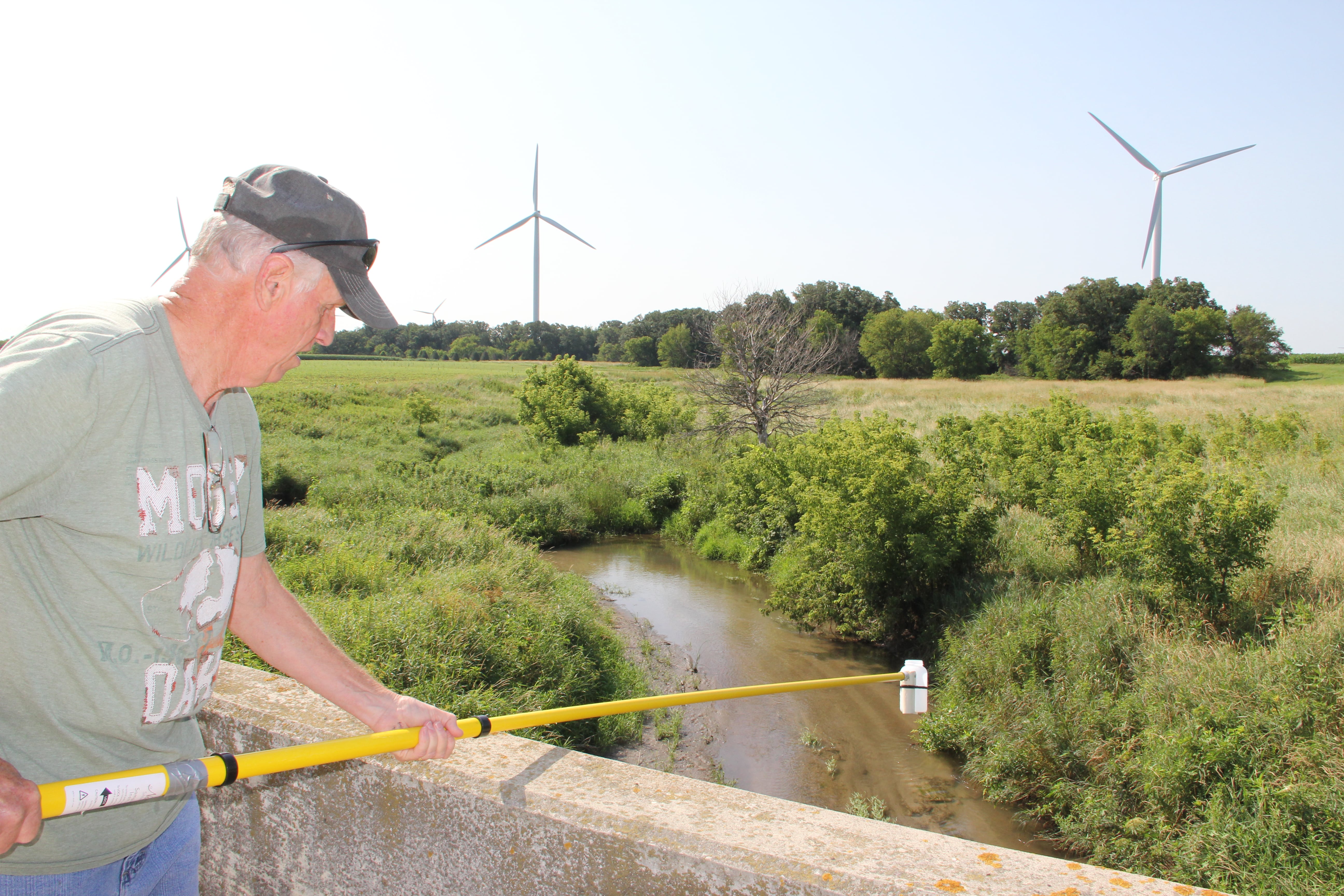
Water Water Quality Sampling in the Upper Wapsipinicon River Watershed The Upper Wapsipinicon River Watershed is fairly new to surface water quality monitoring at the whole watershed scale. The Upper Wapsipinicon River Watershed Management Authority started water sampling with the help from partner organizations in 2015. Since then, samples were gathered in 2016, 2017, and [...]
The impact of any individual flood event in the Upper Wapsi River Watershed is dynamic and complicated. It can include loss of life, direct and indirect economic loss and stressors, social, psychological, and cultural impacts, public and private physical infrastructure degradation or loss, property damage or loss, and business loss. The ecological impacts, including water [...]