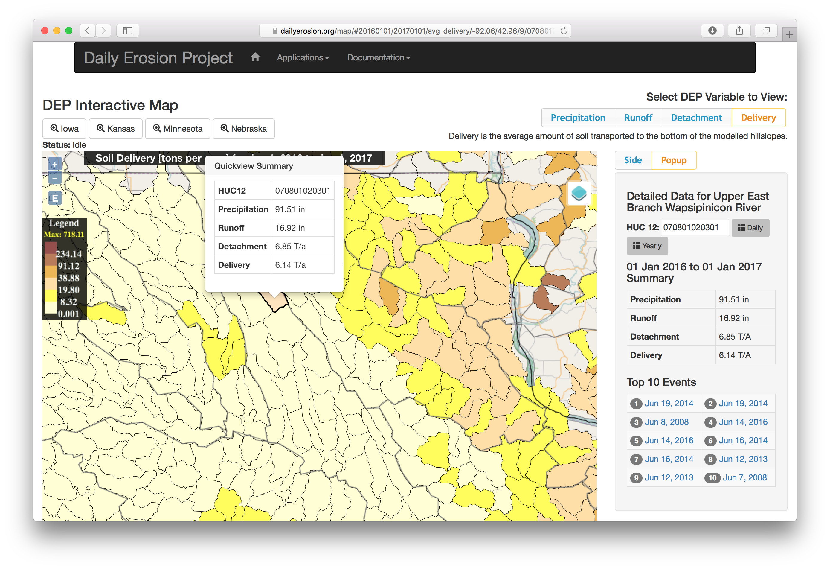
The Daily Erosion Project (DEP) estimates precipitation, runoff, sheet and rill erosion, and hillslope delivery in near real time, on over 2000 watersheds in the Midwest (Figure 1). It does this by running the Water Erosion Prediction Project (WEPP) model with a combination of remotely-sensed precipitation weather stations, remotely-sensed crop and residue cover, remotely-sensed topography, and soils databases.
It is an update and expansion to the Iowa Daily Erosion Project (Cruse et al., 2006) that is designed to further investigate large scale erosion dynamics while maintaining hillslope level input resolution. The DEP has a climate database extending from 2007 to the present day, enabling investigation of single event and single year runoff and soil erosion dynamics over a large time range and spatial extent.